
Motorists returning to Sydney and nearby areas should remain vigilant and exercise caution while driving, as last night’s heavy rain has increased risks on the roads, with more showers predicted.
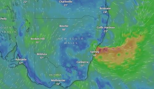
The Bureau of Meteorology has indicated that an upper-level low-pressure system over central inland New South Wales is moving eastward towards the coast, likely bringing additional heavy rainfall and possible thunderstorms.

Strong and gusty winds may result in dangerous surf across the east coast too.
Peak gusts reaching 90km/h are expected on the Hunter coast and southern mid-north coast of NSW.
The NSW SES has warned long weekend travellers to stay alert, never drive or walk through flood water and to keep clear of storm drains and creeks.
The SES recorded 64 incidents since 7pm yesterday, 14 of which were in Sydney.
Conditions are set to ease slightly by Monday however scattered showers and rain are expected to still develop across the east coast.
Isolated storms are also forecast to impact south-east Queensland and parts of Victoria.
Several minor flood warnings remain in place for areas across Queensland’s south-east and north of Brisbane.