
Thursday afternoon was hot with highs in the upper 80s to lower 90s.
Though thanks to a cold front brining in dry air at the surface, heat index values remained below the actual air temperatures.
Thursday night, dewpoint temperatures remain in the 50s, ensuring a comfortable atmosphere. With clear skies and dry air, overnight lows will likely drop to the low to mid-60s throughout most of the Coastal Empire and Lowcountry.
A few outlying locations may be able to cool into the upper 50s by Friday morning.

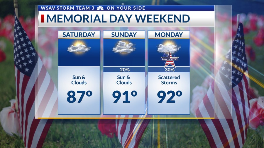
Memorial Day weekend will start out with a mostly sunny sky on Saturday with afternoon highs reaching the upper 80s to lower 90s.
Heat index values will only be a few degrees above the forecast highs as humidity level will not begin to really increase until Sunday.
Hotter temperatures and some thunderstorm chances will enter the forecast on Sunday and for Memorial Day itself.
Both days will see high temperatures reaching the lower 90s, accompanied by a few showers and thunderstorms. Some of these isolated storms could become strong to severe because of the summer-like heat.
The hot trend on the lower 90s with some storms will continue into the middle of next week.


