
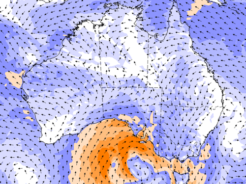
The first cold front is moving from Tasmania to parts of South Australia and western Victoria from Saturday afternoon, bringing with it showers and isolated thunderstorms.

There is also a risk of isolated damaging wind gusts in elevated parts of Victoria this evening, before the cold front is expected to weaken.
Meteorologists believe the second front will pose more serious danger when it reaches Adelaide on Sunday night, bringing a band of rain, showers and thunderstorms.
Strong wind gusts between 80 and 100km/hr are expected to hit parts of SA and western Victoria on Sunday evening, before extending to the rest of Victoria and NSW on Monday and Tuesday.
Snow is possible in elevated areas on Tuesday, when the coldest of the air travels through southeastern parts of the country.
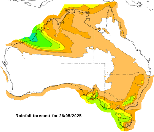
In terms of rainfall, moderate falls between 5-15mm can be expected along the southern coastline to Tuesday night.
Higher totals are expected across Tasmania and parts of Victoria and south-eastern NSW.
The Bureau of Meteorology urged residents in affected areas to stay across the latest weather warnings.
“In terms of warnings, there are no current at the moment, but we will be issuing warnings for damaging to destructive wind gusts,” meteorologist Jonathan How said.
“These will include very broad areas, including much of south-eastern South Australia, Victoria and south-eastern parts of New South Wales.
Weakened trees from a dry autumn could cause a heightened risk of fallen trees and branches.
Across the SA coast, waves are tipped to exceed eight to 10 metres on Sunday and Monday, bringing hazardous coastal conditions from Port Lincoln through to the Gulfs and towards Victor Harbour.
Large swell will also impact Victoria’s south-western coast on Monday and head through to the east coast of the country on Tuesday.
Conditions will only clear from the middle of the week.