Share this @internewscast.com
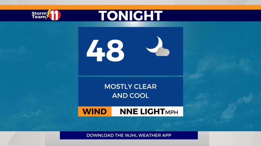
The Storm Team 11 forecast calls for showers will come to an end with gradual clearing overnight. The low will be around 48 degrees.

The clear skies present a perfect opportunity to view the Aurora Borealis, also known as the Northern Lights. In this southern latitude, you will need your phone to catch a glimpse. Utilize a long exposure shot directed towards the northern horizon and ensure you’re in an area free from light pollution.

Moving into next week, a warm-up is anticipated, with temperatures exceeding the average. The smoke from Canadian wildfires is expected to persist into the coming week. On Monday, temperatures will climb back to near average under predominantly sunny skies, reaching a high of 80 degrees. Monday night will remain mostly clear, with temperatures dropping to a low of 50 degrees.


The warming trend will continue on Tuesday, with only a few clouds passing by. The high is projected to be around 84 degrees. Tuesday night should also be mostly clear, with lows around 60 degrees.


Wednesday will be mostly sunny, hot and humid. The high will be 85 degrees and feel like 87. Wednesday night will be mostly clear with a low of 58 degrees.

We stay hot and humid on Thursday with increasing clouds through the afternoon. The high will be 85 degrees and feel like 88. Thursday night will be partly cloudy and mild with a low of 62 degrees.

By Friday, the ridge of high pressure will start to break down with a 30% chance of pop-up showers and thunderstorms. It will remain hot and humid. The high will be 84 degrees and feel like 86. Friday night will be mostly cloudy with scattered showers and a few thunderstorms at times. The low will be 64 degrees.

Scattered showers and thunderstorms return to the forecast Saturday with a 60% rain chance. The high will be 81 degrees under mostly cloudy skies.

Next Sunday will also be wet with a 60% chance of scattered showers and thunderstorms. The high will be around 82 degrees.

Have a great night.