

ORLANDO, Fla. – It’s starting off pretty nice and dry across Central Florida this morning, but get ready for some serious heat by the afternoon.
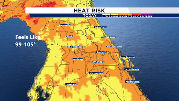
Temperatures are anticipated to rise to the low to mid-90s, but with the humidity, it will feel closer to the low 100s, so ensure to drink plenty of water to stay cool and hydrated.
Rain chances are on the lower side, around 30-40%, and the coast will stay a bit drier.
[EXCLUSIVE: Become a News 6 Insider (it’s FREE) | PINIT! Share your photos]
If you’re heading to the beach, expect it to be hot and muggy with a light southeast breeze around 5-15 mph, gusting up to 25 mph.
Rain is expected to begin after 2 p.m., primarily west of Interstate 4. Some storms may bring gusty winds (approximately 40 mph), heavy rain, and lightning, so remain vigilant if you’re outdoors.
Sunday seems to bring more of the same conditions, hot and humid with a 30-40% chance of rain and highs in the low to mid-90s. As the week progresses, the heat will persist, with temperatures rising to the mid to upper 90s, but we’ll get a slight relief midweek with drier air, reducing rain chances to 30%.
So, it’s going to be one of those weeks where you’ll want to stay cool and be prepared for some afternoon showers!
Copyright 2025 by WKMG ClickOrlando – All rights reserved.