
The pursuit
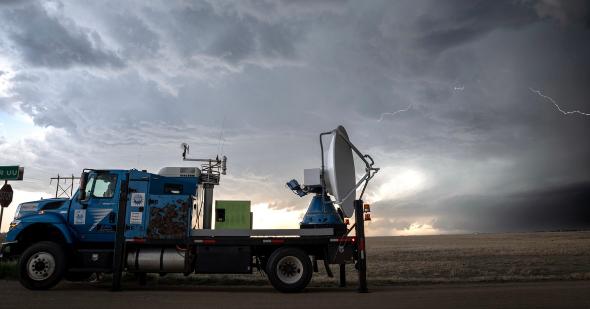
From mid-May until the close of June, ICECHIP storm chasers navigated the Front Range of the Rockies and the central Plains, occasionally using vehicles fortified to withstand falling ice. They deployed drones, launched weather balloons, and utilized mobile Doppler radars—strategies perfected by those who chase tornadoes.
While one team set up mobile Doppler radars to monitor the storm up close, other researchers released weather balloons nearby or placed sensors to assess hail size and impact speed.
In certain storms, researchers discharged hundreds of small, pingpong ball-sized gadgets known as hailsondes into the storm’s path to study the lifecycle of a hailstone—tracking when it melts and refreezes, and observing how wind patterns that raise and lower these ice chunks influence their growth.
Convective thunderstorms, with big internal updrafts, generate hail by circulating a mix of water and ice crystals into the freezing layers of the upper atmosphere. Hail typically forms at altitudes of 20,000 to 50,000 feet, where temperatures are between minus 22 degrees and 14 degrees Fahrenheit. Those same updrafts sweep hailsondes into the hail-generating parts of each storm.

“If we can track that sensor with time, we’re going to, at least for a couple of these storms, understand the exact path, the exact trajectory that a hailstone takes,” said Victor Gensini, a professor of meteorology at Northern Illinois University and an ICECHIP principal investigator.
In an atmosphere warmed by climate change, “we get a lot more instability,” Gensini said, which researchers think creates stronger updrafts.
Those stronger updrafts can support larger hailstones for more time, which allows balls or discs of ice to gain mass, before gravity sends them racing to the ground.
“It’s kind of like if you take a hair dryer and turn it on its end, it’s pretty easy to balance a pingpong ball, right, in that airstream,” Gensini explained. “But what would you need to balance a softball? You would need a much stronger updraft stream.”
Storm modeling suggests stronger updrafts will increase the frequency of large hail in the future, even as it decreases the likelihood of hail overall. Researchers suspect small hail will decrease because its lower mass means that it will take longer to fall. By the time it’s close to the surface, it has often melted down to water.
“There’s this kind of dichotomy, right, where you get less small hail but more large hail in these warmer atmospheres that have very strong updrafts,” Gensini said.
During their field campaign, the researchers amassed a collection of more than 10,000 hailstones in chests of dry ice to try to determine if their computer models are getting the dynamics of hail growth right.
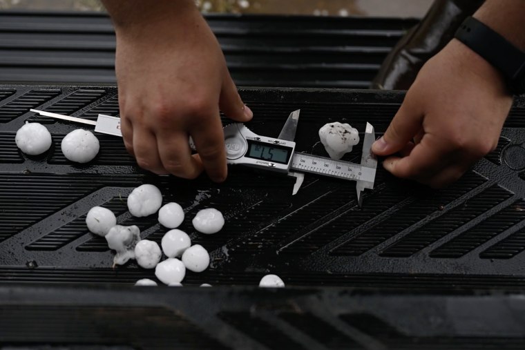
“The hail record is kind of messy,” Gensini said of previous data, adding that observers have recorded more 2-, 3- and 4-inch hailstones, but it’s not clear if that’s because more people are chasing and finding big hail or because the atmosphere is producing more of it.
Gensini said the new measurements will help researchers compare what is happening in the air to what they’re finding on the ground, which should improve hail forecasts and mitigate economic losses.
In many of the areas where ICECHIP is working, there’s a lot of agriculture, according to Karen Kosiba, an atmospheric scientist with the University of Illinois Flexible Array of Radars and Mesonets team who is also working with ICECHIP.
“It affects their crops, their machinery, getting stuff into shelter,” she said. “There’s a lot of economic ties to the weather.”