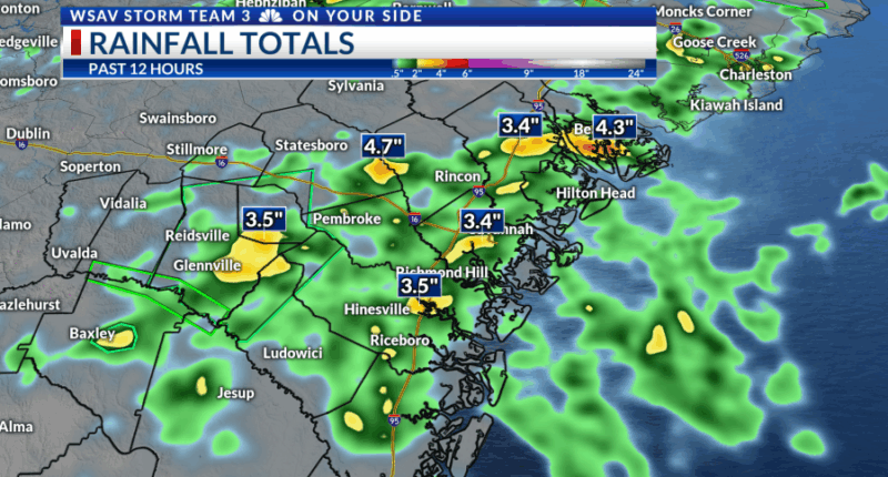
SAVANNAH, Ga. () — Thunderstorms developed across the Coastal Empire & Lowcountry, bringing some strong storms & heavy rainfall.
In some regions, over 4 inches of rain fell in less than 2 hours, resulting in occasional flood alerts. The activity gradually diminished near sunset as the atmosphere settled and cooled.

On Sunday, the day will begin warm and muggy, transitioning to a hot and humid afternoon. With less atmospheric lift and instability, storm chances are expected to be around 30%.


Partly due to the distant Hurricane Erin, winds from the northeast will slightly reduce humidity and limit rain chances to occasional storms from Monday through Wednesday. Rain chances are expected to gradually increase by the week’s end.
Erin quickly escalated to a Category 5 hurricane shortly after 11 AM Eastern, intensifying from a Category 1 in just 24 hours. The system is predicted to turn northward in the coming days, avoiding a direct impact on the Coastal Empire and Lowcountry.
The storm will cause waves to extend across the Western Atlantic, leading to dangerously high surf and a significant risk of rip currents throughout the week.
No direct impacts are expected to the area but be safe if you have any beach plans due to the dangerous surf conditions.
As of Saturday evening, a new area of focus has emerged, moving off the African coast. A low-pressure area may form between Africa and the Caribbean, currently having a 20% chance of developing into a tropical depression or named storm.
It is important to remember that it is the time of year for these systems. Anything that develops would be a week from reaching the Caribbean, and there is no certain outcome yet given that nothing has formed.


