
ORLANDO, Fla. – Although Hurricane Erin will remain well away from Florida’s shoreline this week, its influence will still be notable as it moves across the open Atlantic.
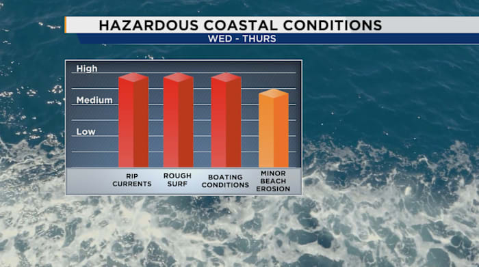
Our east coast will see some rough coastal conditions starting to worsen by Tuesday, with the worst of it hitting Wednesday and Thursday.
Starting Monday, the state can expect turbulent surf and a heightened danger of rip currents, with the most severe conditions predicted mid-week. Erin is generating swells that pose several risks for both those visiting the beach and boating enthusiasts.
[MORE: Rough surf expected this week on Florida’s east coast due to Hurricane Erin]
High rip current risks will impact all east coast beaches starting Monday and growing through the week.
Wave activity is anticipated to be intense, with heights potentially reaching 5 to 8 feet, particularly from Tuesday night to Thursday. This could lead to some erosion of beaches and dunes, in tandem with higher tides.
Boaters, particularly near inlets, are urged to remain vigilant. Close to the coast, waves could measure 6 to 8 feet, and offshore, they could climb to 9 to 11 feet, creating perilous conditions until Thursday. Exercise caution, whether enjoying the beach or navigating the waters!
Copyright 2025 by WKMG ClickOrlando – All rights reserved.