

ORLANDO, Fla. – Although Hurricane Erin is currently commanding attention with its potential to bring hazardous coastal surf to the U.S. East Coast, there is another system further into the Atlantic that could become the next named storm soon, according to the National Hurricane Center.
Next Area to Watch
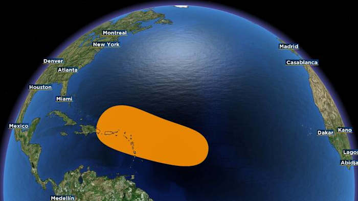
An expansive cluster of unorganized thunderstorms and showers has formed around a tropical wave emerging from Africa’s coast. While immediate development isn’t anticipated, conditions could become more conducive later this week. The National Hurricane Center has assigned it a 50% chance of developing over the next week, as it heads west or northwest at approximately 20 mph.
It could approach the Leeward Islands by Friday.
Computer models vary on the path of the potential system, and it’s too early to tell where exactly the area of interest will track.
If it becomes our next named storm, it will be called Fernand (pronounced fair-NAHN).
This scenario is typical during the “Cabo Verde season,” when tropical waves leave Africa and frequently develop into long-traveling storms across the Atlantic. These systems have ample time and warm waters to intensify.
With Erin currently the primary concern in the Atlantic, the emerging tropical wave could potentially shift to the forefront of tropical weather discussions in the coming weeks.
Should it develop into Fernand, it would mark a progression into the most historically active period of hurricane season, which stretches from late August through September.
Copyright 2025 by WKMG ClickOrlando – All rights reserved.


