
MIAMI — Hurricane Erin caused tourists in North Carolina’s Outer Banks to end their vacations early, although the powerful storm is anticipated to remain offshore after hitting parts of the Caribbean with rain and wind on Monday.
Evacuations were initiated on several barrier islands along the North Carolina coast as authorities cautioned about the potential for hazardous rip currents and roads being flooded by waves as high as 15 feet. On Monday, tropical storm and surge watches were announced for much of the Outer Banks.
Tourists and residents waited for hours in a line of cars at Ocracoke Island’s ferry dock – the only way to leave other than by plane.
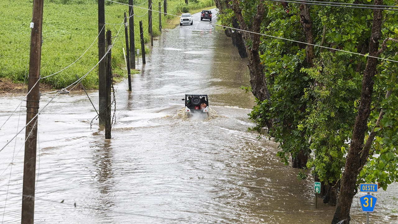
Vehicles traverse a flooded road in Naguabo, Puerto Rico, as Hurricane Erin brings heavy rain to the island on Sunday.
Alejandro Granadillo
Officials at Wrightsville Beach, close to Wilmington, North Carolina, reported rescuing at least 60 swimmers from dangerous rip currents to the National Weather Service on Monday.
“We definitely thought twice,” stated Seth Brotherton from Catfish, North Carolina, whose fishing trip meant to last a week ended after just two days. “But when they said ‘mandatory,’ it basically meant, ‘leave immediately.’
Meteorologists are confident that Erin will veer northward, away from the eastern United States, yet it is still expected to generate high waves and tropical force winds over the coastal islands, explained Dave Roberts from the U.S. National Hurricane Center in Miami.
The storm strengthened to a Category 4 with maximum sustained winds of 140 mph on Monday while impacting the Turks and Caicos Islands and the southeast Bahamas, as reported by the center.
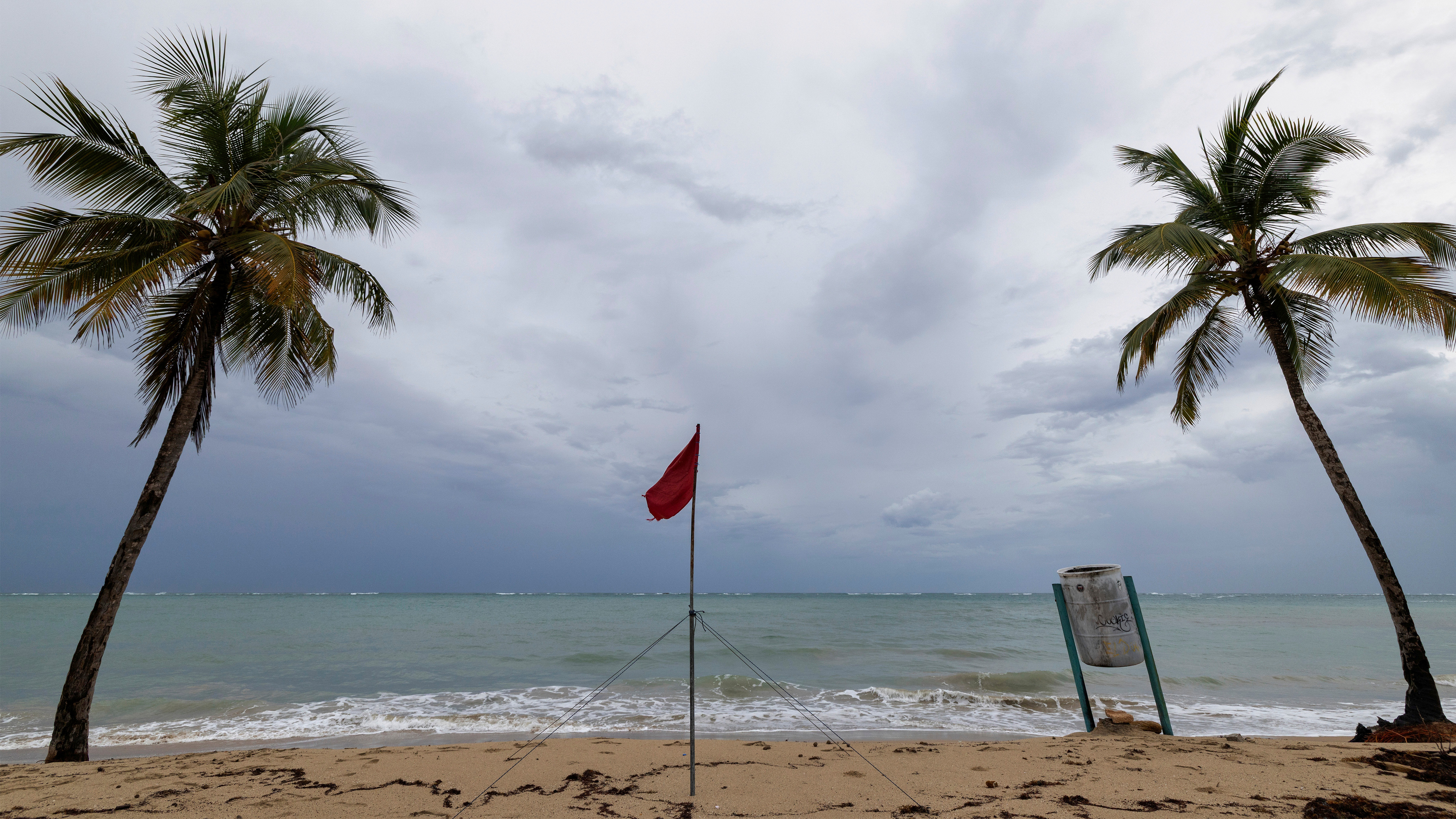
A red flag warns of dangerous waves on an empty beach in San Juan, Puerto Rico, after Hurricane Erin passed by near the island on Sunday, Aug. 17, 2025.
AP Photo/Alejandro Granadillo
Government officials in the Turks and Caicos Islands said all services were suspended on three of its islands and ordered residents there to stay home. Some ports also closed.
By late Monday afternoon, the storm was about 700 miles southwest of Bermuda and about 815 miles southeast of Cape Hatteras.
On the Outer Banks, coastal flooding was expected to begin Tuesday and continue through Thursday.
The evacuations that began Monday on Hatteras Island and Ocracoke came at the height of tourist season on the thin stretch of low-lying barrier islands that jut into the Atlantic Ocean and are increasingly vulnerable to storm surges.
A year ago, Hurricane Ernesto stayed hundreds of miles offshore yet still produced high surf and swells that caused coastal damage.
This time, there are concerns that several days of heavy surf, high winds, and waves could wash out parts of the main highway, the National Weather Service said. Some routes could be impassible for several days, authorities warned.
This is the first time Ocracoke has been evacuated since Hurricane Dorian struck in 2019, leaving behind the most damage in the island’s recorded history.
Tommy Hutcherson, who owns the community’s only grocery store, said the island has mostly bounced back. He’s optimistic this storm won’t be as destructive. “But you just never know. I felt the same way about Dorian, and we really got smacked,” he said.
Daniel Pullen, a professional photographer who lives on Hatteras Island, said he’s already lost three days of work shooting family portraits because of the evacuation order.
Pullen, who lives in Buxton, doesn’t plan to evacuate because he could be stuck off the island for days and even weeks if the main road, Highway 12, washes out.
“It’s a bit like Russian roulette,” Pullen said. “Do you stay and take the chance of it hitting you? Or do you leave and take the chance of getting stuck off the island for weeks at a time? I would say the majority of Hatteras Island residents can’t afford to stay in a motel for a week or two weeks.”
Erin, the year’s first Atlantic hurricane, reached a maximum Category 5 status Saturday with 160 mph winds before weakening. It is expected to remain a large hurricane into midweek.
“You’re dealing with a major hurricane. The intensity is fluctuating. It’s a dangerous hurricane in any event,” the hurricane center’s Richard Pasch said.
Bermuda will experience the most severe threat from Erin on Thursday evening, said Phil Rogers, director of the Bermuda Weather Service. By then, waters could swell up to 24 feet.
“Surfers, swimmers and boaters must resist the temptation to go out. The waters will be very dangerous and lives will be placed at risk,” acting Minister of National Security Jache Adams said.
Erin’s outer edges hit parts of Puerto Rico and the Virgin Islands with heavy rains and tropical storm winds on Sunday and knocked out power to thousands.
The Associated Press contributed.
Copyright © 2025 KABC Television, LLC. All rights reserved.