Share this @internewscast.com
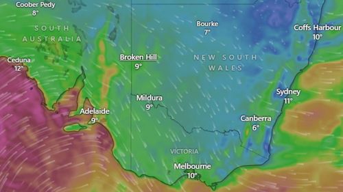
Victorians have been cautioned about the imminent threat of dangerous winds, power disruptions, and toppled trees as a strong cold front sweeps through Australia’s southeastern states.
“We have not seen a significant weather event like this in some years,” Emergency Management Commissioner Tim Wiebusch stated during an afternoon press conference.
Meanwhile, the South Australian State Emergency Service (SES) has responded to numerous assistance calls following a severe storm that hit the state earlier today.

Here’s everything you need to know about the powerful polar blast sweeping across SA, Victoria, NSW and Tasmania.
Victorians are bracing for damaging winds and gusts exceeding 100 km/h in some areas on Friday afternoon an into Saturday morning.
Potentially impacted areas include Melbourne, Geelong, Mildura, Horsham, Warrnambool, Maryborough, Ballarat, Stawell, Hamilton, Portland, Wonthaggi, Bacchus Marsh, Dandenong Ranges, Mt Hotham, and Mt Buller.
Gusts of 113km/h have already been recorded at Mt Hotham, as well as 100km/h gusts at Mt Buller, 94km/h at Horsham in the state’s west.
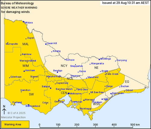
Five watch and act warnings have been issued across Victoria.
“Expect that there will be power outages. Expect that there will be fallen power lines,” Wiebusch said today.
He urged residents to charge their mobile phones and avoid unnecessary travel, especially in areas with lots of tree coverage.
He also warned Victorians to secure outdoor items around their homes to ensure they don’t “become missiles” when winds pick up.
Victoria State Emergency Service (VICSES) has already received 76 requests for assistance and those numbers are growing.
It has also seen two cars and one person impacted by a tree, according to state agency commander Mark Cattell.
The cold front could also produce blizzard conditions in some alpine areas, according to Bureau of Meteorology senior meteorologist Kirsty Turner.
The worst weather is expected overnight and locals have been warned to stay indoors.
“Stay alert, avoid unnecessary travel, and if possible, remain safely indoors,” advised Cattell.
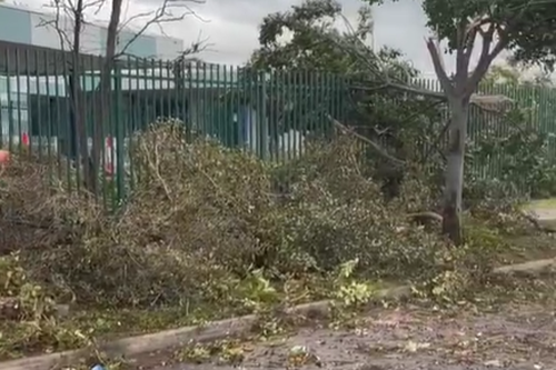
Multiple trees have already been brought down in SA, where damaging winds have snapped massive gum trees in half, blocking roads and damaging homes.
One resident in the Elizabeth area told 9News that he heard a loud bang, only to find his roof had collapsed onto his driveway and over his cars.

The weather system will bring damaging winds, showers and snow today and into the weekend.
Weather conditions are expected to improve gradually from the west in the evening, although some impacts could persist into the late evening in the state’s Lower South East.
Communities which may be affected include Adelaide, Port Lincoln, Whyalla, Renmark, Mount Gambier and Ceduna.
The Bureau of Meteorology has issued severe weather warnings across the state, where wind gusts are expected to reach up to 130km/h in some areas.
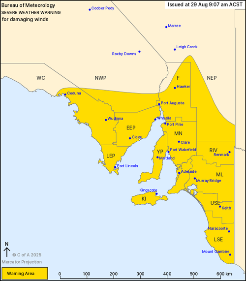
A gale warning was issued by the bureau today for a huge stretch of coastal waters, including the Adelaide metropolitan area.
The SES is advising people to leave their boats at home for the next couple of days.
Warnings for damaging winds and possible blizzards have been issued in parts of NSW today as the cold front crosses the state.
People in the Snowy Mountains and parts of the Mid North Coast, Hunter, Illawarra, and other regions in the far southwest and elevated parts of the southeast of NSW have been urged to stay vigilant.
Winds averaging 80-90km/h with gusts up to 110km/h are forecast to continue through the night in alpine areas above 1900m.
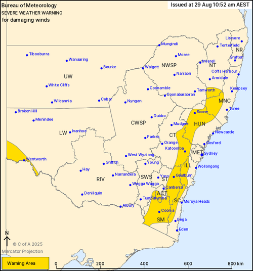
Strong winds are also expected in lower eastern areas and the far southwest, where gusts of up to 90km/h are possible.
Winds are forecast to ease below warning thresholds by Saturday evening.
The NSW National Parks and Wildlife Service has urged anyone planning back country travel to postpone until the weather improves.
Locations which may be affected by the wild weather include Goulburn, Scone, Katoomba, Cooma, Wentworth, Bowral, Braidwood, Nowendoc, Thredbo, Perisher and Gloucester.
Sydney, where the Sydney Marathon is set to be held on Saturday, should not be affected.
A severe weather warning has also been issued for parts of Tasmania.
People in King Island and parts of North West Coast, Central North, Central Plateau and Midlands Forecast Districts are bracing for vigorous southerly winds from the same low pressure system affecting much of the south east coast.
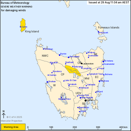
Damaging winds averaging 60 to 70 km/h with peak gusts up to 110 km/h are possible from tonight in King Island.
Residents in the Great Western Tiers have been warned to expect the same, with conditions to ease on Saturday morning.
