

ORLANDO, Fla. – On Sunday, Tropical Storm Imelda developed and is predicted to strengthen into a hurricane, potentially veering away from the U.S. East Coast by early next week.
The previous tropical storm alerts for Brevard and Flagler Counties have been lifted, but it’s not time to get complacent. Beginning Monday, high surf and wind advisories will be active.
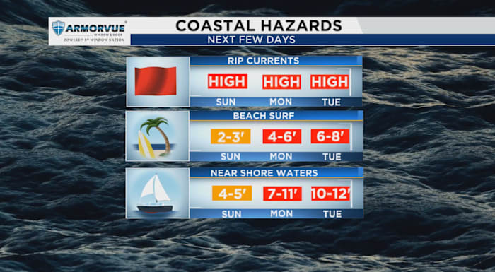
Expect turbulent waters, with wave heights reaching 6 to 10 feet. In tandem with these formidable waves, rip currents pose a significant threat. Such strong currents can sweep even skilled swimmers into deeper parts of the ocean.
This isn’t a short-lived situation; the elevated rip current risk will persist until Wednesday night. Residents near Volusia, Brevard, or Indian River counties should also be prepared for potential localized beach erosion.
If you do need to be near the water, keep an eye on lifeguard flags and signs—they’re there to keep you safe.
In addition to dangerous conditions at the shore, powerful winds are forecasted to move through the region. Winds from the north to northwest will range from 20 to 30 mph, with gusts potentially reaching 40 mph. These gusts may dislodge unsecured items, break tree branches, and could result in power outages. It’s prudent to keep mobile devices charged as a precaution.
Copyright 2025 by WKMG ClickOrlando – All rights reserved.