
ORLANDO, Fla. – Tropical Storm Jerry is swiftly advancing across the Atlantic, with projections indicating it will intensify into a hurricane by Thursday. Meanwhile, a weak weather disturbance in the Bay of Campeche could result in heavy rainfall and strong winds for southern Mexico.
Tropical Storm Jerry
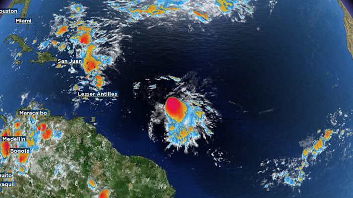
Tropical Storm Jerry remains poorly organized Wednesday morning, with most of its thunderstorms displaced to the south and east of its center.
NOAA and Air Force Hurricane Hunter aircraft are scheduled to take a closer look at the storm Wednesday afternoon.
Jerry is progressing west-northwest at approximately 20 mph, steered by a robust ridge over the central Atlantic. Predictions suggest the system will decelerate and strengthen in the upcoming days, achieving hurricane strength by Thursday as it nears or travels north of the northern Leeward Islands from late Thursday into Friday.
By Friday, a jet stream dip in the western Atlantic is expected to redirect Jerry northward, and then northeast early next week, keeping the storm from approaching the U.S.
Tropical storm watches remain in effect for parts of the northern Leeward Islands.
Gulf System
In the Bay of Campeche, a low-pressure trough continues to generate unorganized showers and thunderstorms as it moves toward southern Mexico’s coast.
Though the likelihood of tropical development remains low, with only a 10% chance over the next two to seven days, the system is still anticipated to bring heavy rain and strong winds to southern Mexico until early Thursday.
Copyright 2025 by WKMG ClickOrlando – All rights reserved.