

The East Coast is currently grappling with a significant arctic chill, as temperatures have plunged up to 20 degrees below their usual averages. This frigid weather is also affecting the Midwest and Great Lakes areas, courtesy of a polar vortex originating from central Canada. On Friday, Flint, Michigan experienced a new low, with temperatures hitting -3F, surpassing the previous record of -6F set in 1991, as reported by meteorologists from The Weather Channel.

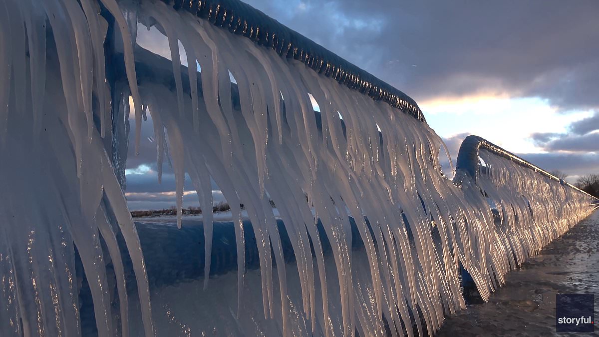
As the weekend progresses, the Northern Plains and upper Midwest should brace for continued sub-zero conditions. Residents in the Dakotas and the upper Midwest can expect temperatures to remain in the single digits and teens. A viral video has captured Lake Michigan in a spectacularly icy state, showcasing “icicle claws” draped over a pier on Friday.

The cold spell is forecasted to linger into the coming week, with cities along the East Coast, such as Philadelphia, New York, and Boston, facing below-freezing temperatures combined with strong winds, intensifying the chill. While the Northeast is likely to endure this wintry weather for several more weeks, there is a silver lining for the Great Plains, which are anticipated to enjoy milder conditions, with temperatures rising to the 50s next week. Long-term forecasts from AccuWeather suggest that these arctic blasts will persist until mid-December.

AccuWeather Lead Long-Range Meteorologist Paul Pastelok said in a news release that the polar vortex has been in a weakened state since November, meaning cold air from the North Pole is being pushed to parts of the US. A polar vortex occurs when strong winds form in the stratosphere above the North Pole. When the vortex is stable, it stays above the North Pole, but if it’s disrupted, warm air moves North while cold air moves South.

‘We are seeing the result as Arctic air pushes southward across the central and eastern US in recent days and may continue to do so for the next couple of weeks or so in waves,’ Pastelok added. AccuWeather meteorologists have predicted two to three more rounds of intense cold in the Midwest and the East Coast until December 19. Even parts of the US as south as central Florida may experience frost next week.

Pastelok predicted that the fast-moving cold air would likely prevent snowstorms. He added that the best chance for snow on the East Coast is around December 12. Parts of the Great Lakes, the Ohio Valley, and the Appalachians may also see a wintry mix storm around December 13.

However, there is good news for the holiday season as long-range meteorologists expect the cold front to likely subside before Christmas. Minneapolis was so cold on Thanksgiving Day that temperatures dropped below those on Mars.