

ORLANDO, Fla. – Floridians are set to experience a split in weather preferences as Mother Nature gears up for the coming weeks.
For those who revel in Florida’s iconic warm climate, or newcomers escaping the harsh northern chill, there’s good news ahead. The Sunshine State is living up to its name with temperatures remaining comfortably high.
Conversely, if you’re someone who enjoys a hint of seasonal change, you might find the upcoming weather less than ideal.
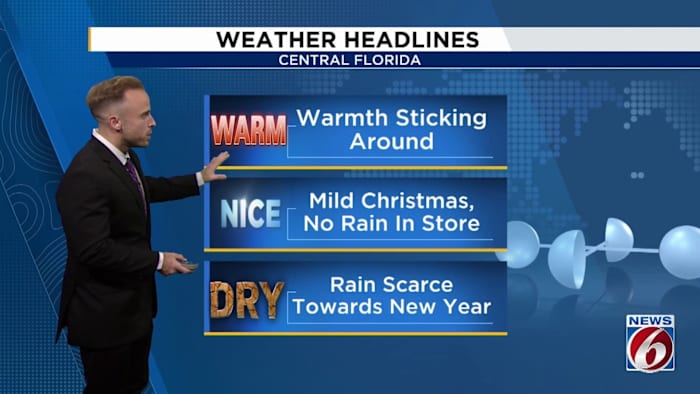
As 2025 draws to a close, the weather appears to have settled into a calm pattern. Both Christmas Eve and Christmas Day promise to be warm and dry, offering pleasant conditions for holiday festivities.
Looking ahead, there are no significant rain prospects on the horizon as we transition into 2026. The La Niña conditions have taken hold, guiding the weather into a steady pattern for the near future.
Across much of the continental United States, temperatures are poised to rise, painting the map in hues of yellow, orange, and red as above-average temperatures persist.
Some long-range computer models suggest that maybe as we get towards New Year’s Eve, during the final moments before the ball drops, the big picture pattern could try to flip on us. This could welcome cooler temperatures and maybe some much needed rain.
But as I dissected all our latest computer model data tonight, I want to emphasize this mention comes with little confidence for the time being. As we move past Christmas and towards the jump into 2026, there seems to be pretty low consistency between which forecast model you look at when determining when the stubborn ridge driving our temps up will start to break down.
In the meantime, as I started this weather update with, if you’re one who appreciates the general warmth and almost spring-like temperatures Florida provides us with even into the winter season, that’s what to expect for the next two weeks roughly.
Your Sunday will be mostly clear, with a mix of sun and some clouds out there streaming in off the Gulf before winds switch up on us into Christmas week.
Winter break couldn’t be more enjoyable with the lack of any big-time rain makers and a ridge holding steady above us in Florida keeping temperatures rather pleasant to be outdoors or wandering the neighborhood, Disney Springs, your choice of venue for Christmas lights and displays.
There is a weak front expected to drop in between Sunday night and Monday which may increase moisture enough to drop a couple sneaky showers on our Atlantic coast counties. Winds in the lowest bits of our atmosphere will be coming in out of the north and east.
Because of these coastal winds, there is a moderate risk for rip currents right along the east coast beaches of Central Florida. So while the weather is actually nice enough to hit the shores, just be careful if you try to tread into the water.
All-in-all, we can all anticipate a rather uneventful end to the year in the weather department, which I know for many of us is an enormous Christmas gift we’re looking forward to!
We’ll be closely monitoring how drought conditions evolve in our area and the rest of Florida, however, given how below normal our rain chances are likely to be as we continue into January.
Copyright 2025 by WKMG ClickOrlando – All rights reserved.