
Harcourt on January 14, 2026.
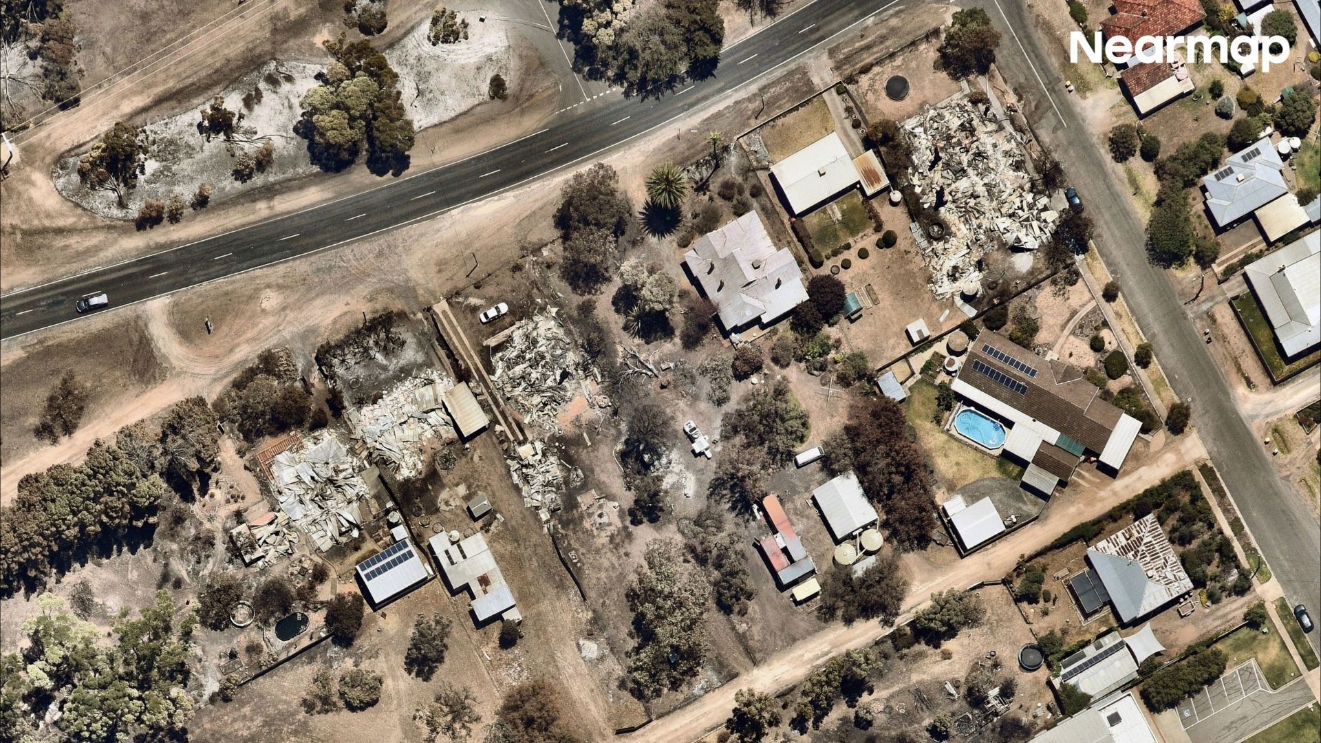
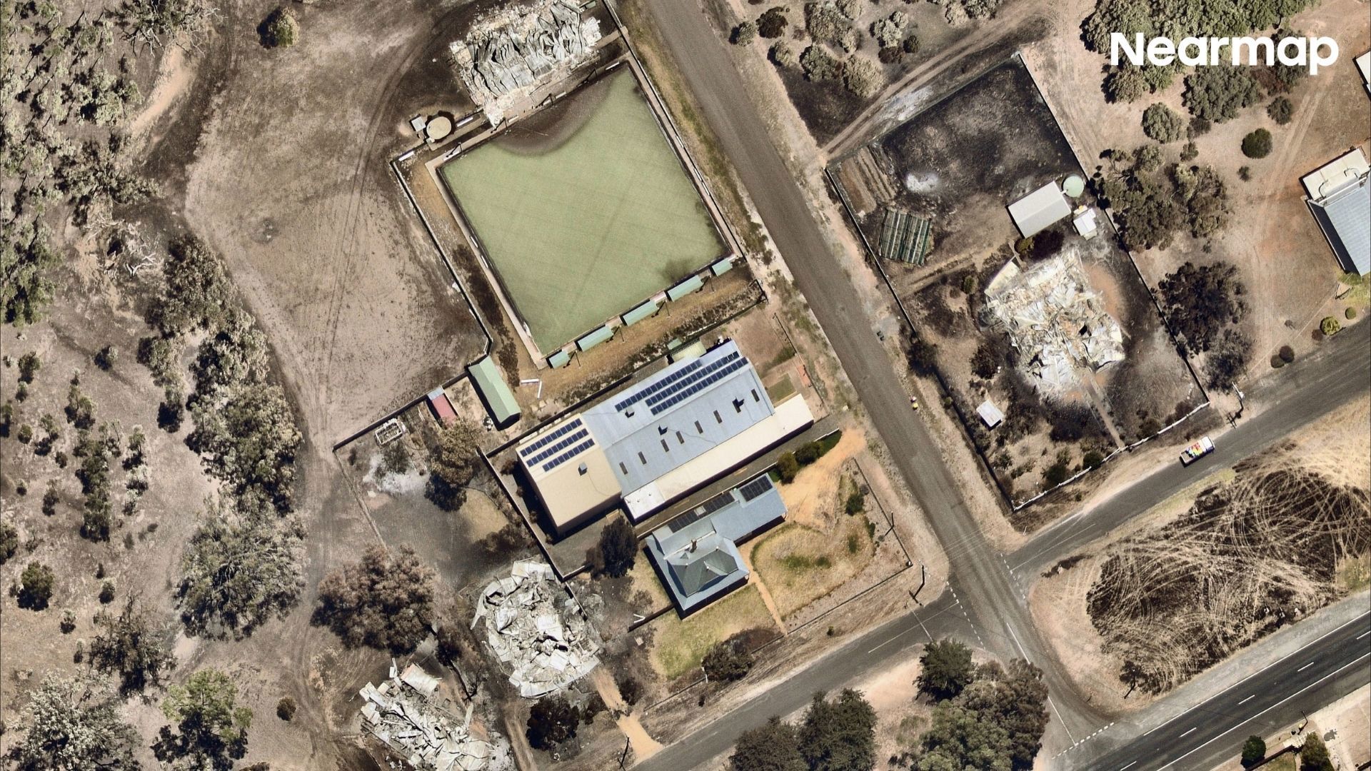
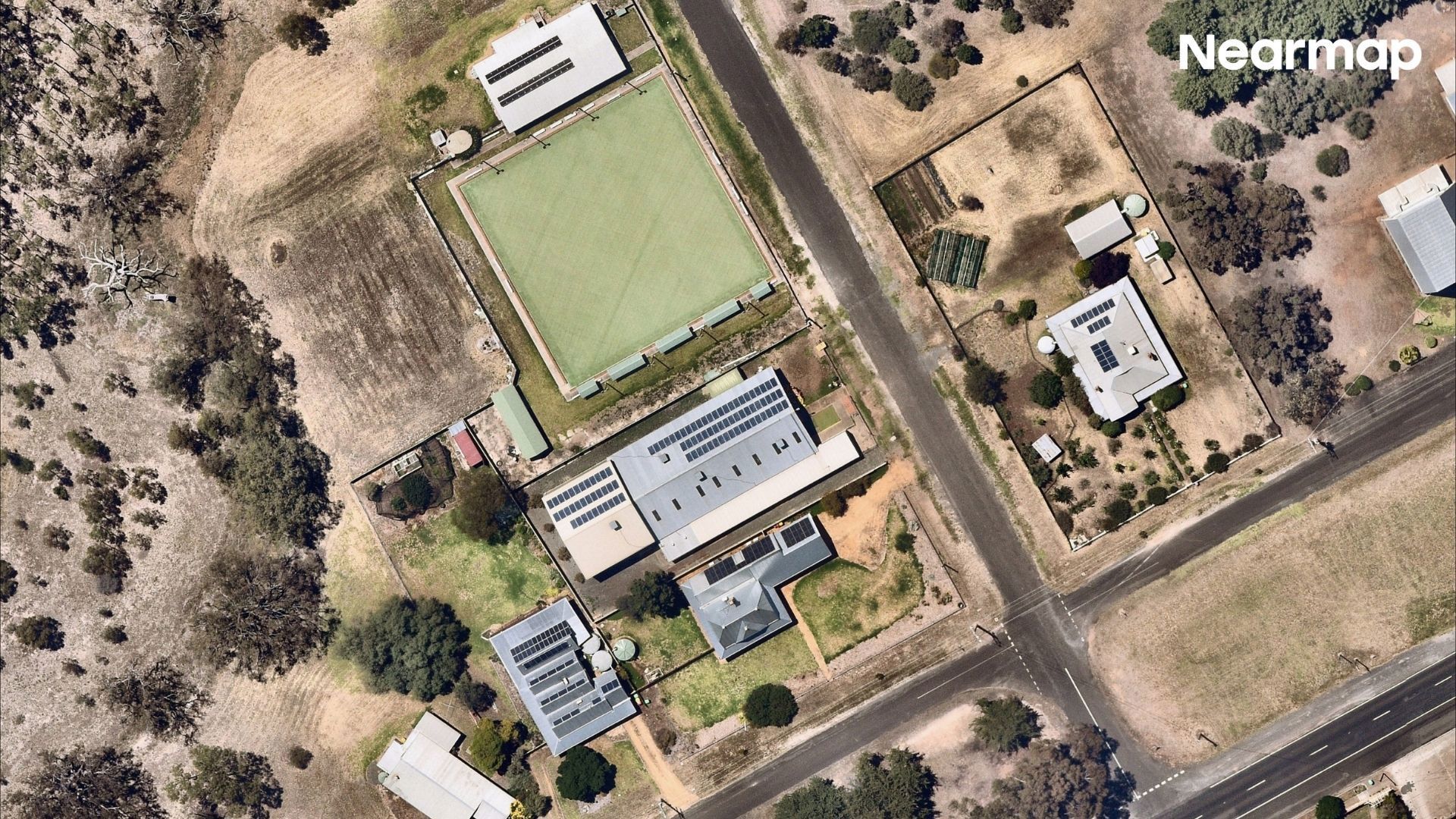
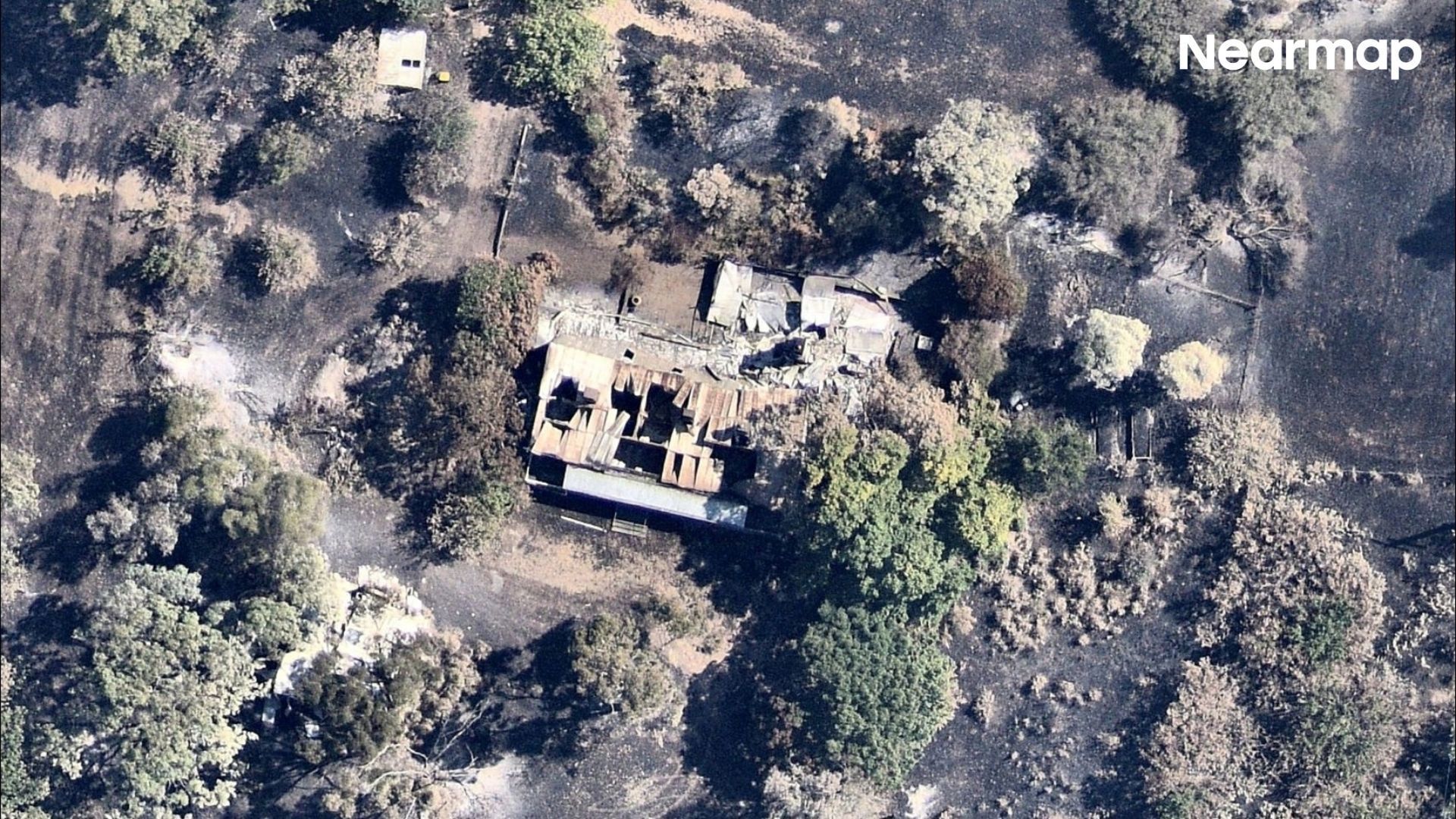
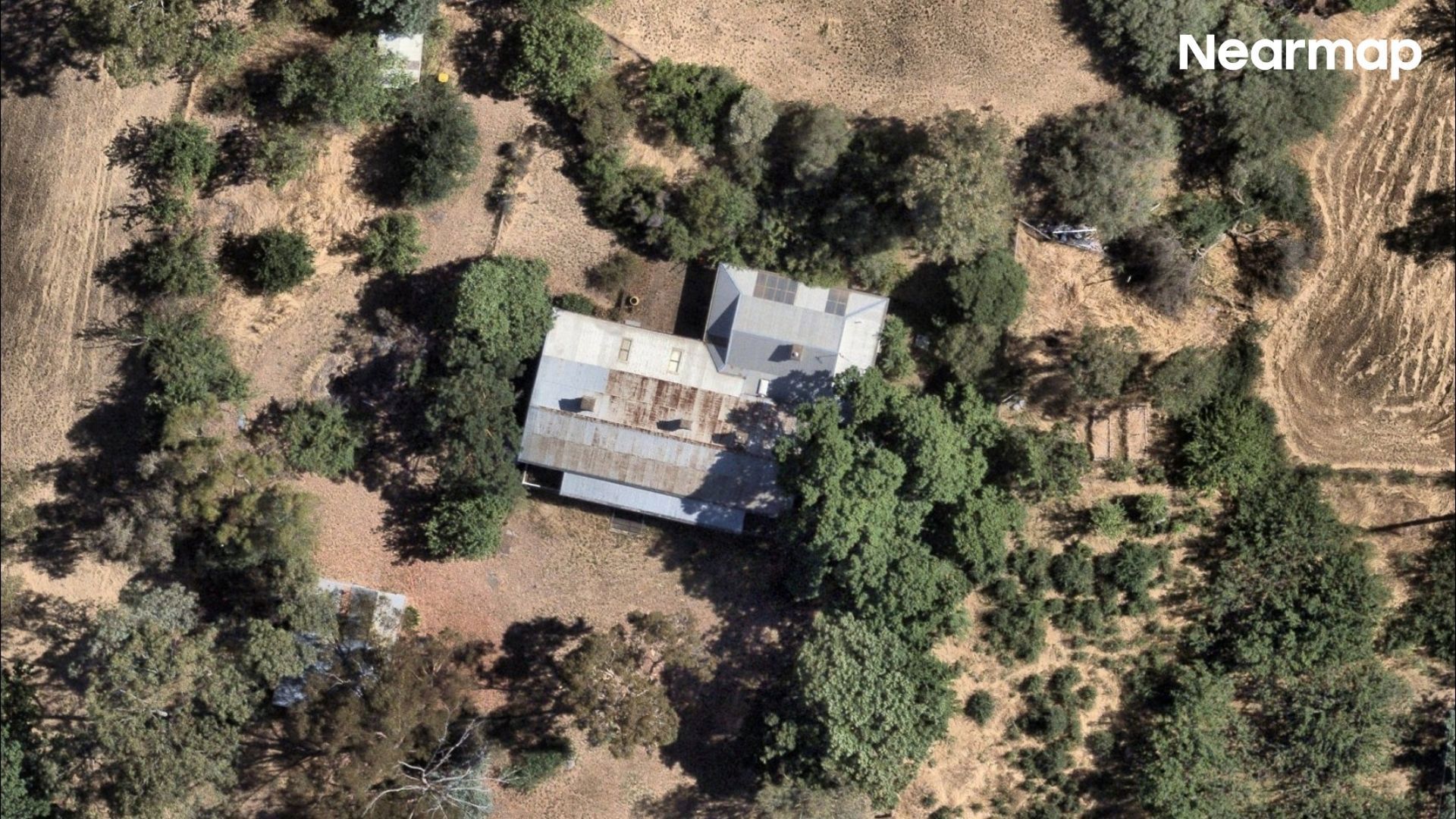
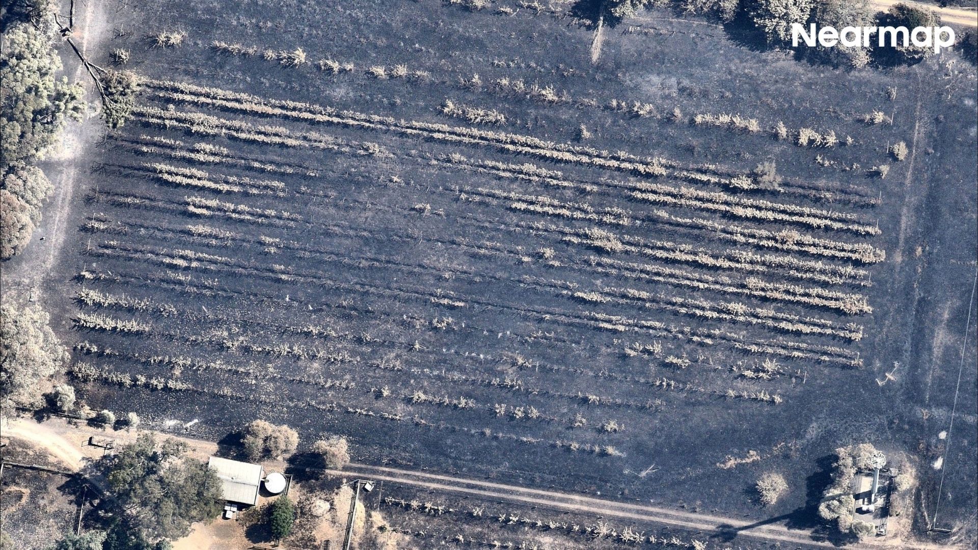
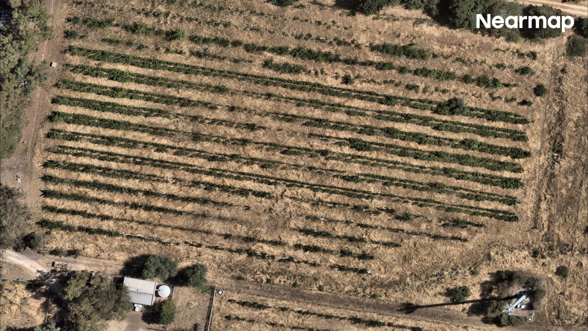
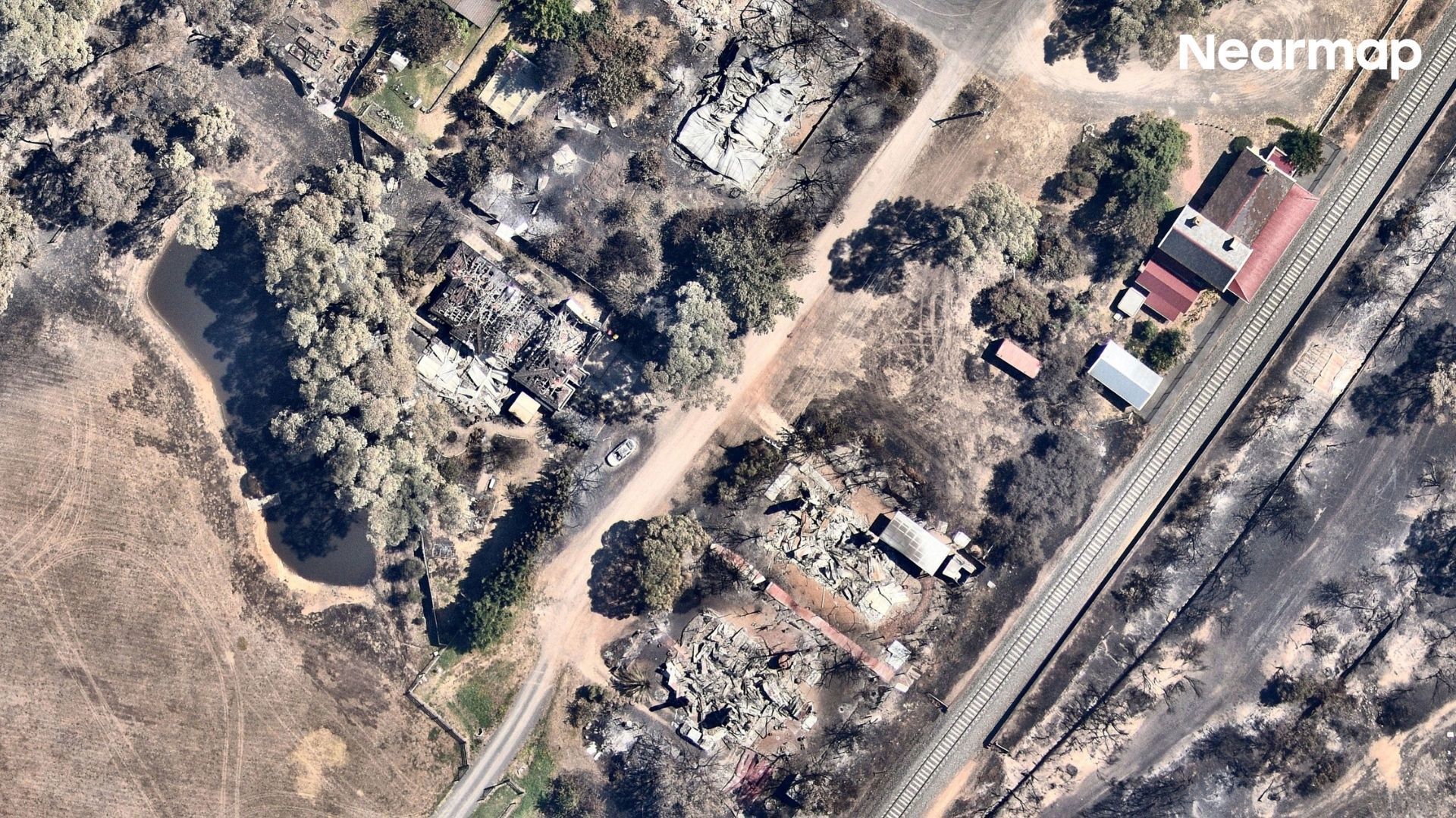
Satellite images of bushfire-ravaged towns have captured the devastating extent of the damage caused by last week’s Victorian bushfire emergency.

Since last Wednesday, devastating fire conditions have ignited numerous fires across Victoria, consuming over 410,000 hectares of bushland.

Among these are significant fires still active in Longwood and Walwa, posing ongoing threats.

More than 1000 structures across Victoria have been damaged or destroyed by the fires, including 290 homes which have been reduced to ash and rubble.
The devastating fires turned deadly over the weekend, after authorities discovered the body of cattle farmer Max Hobson in the Longwood fire ground at Gobur.

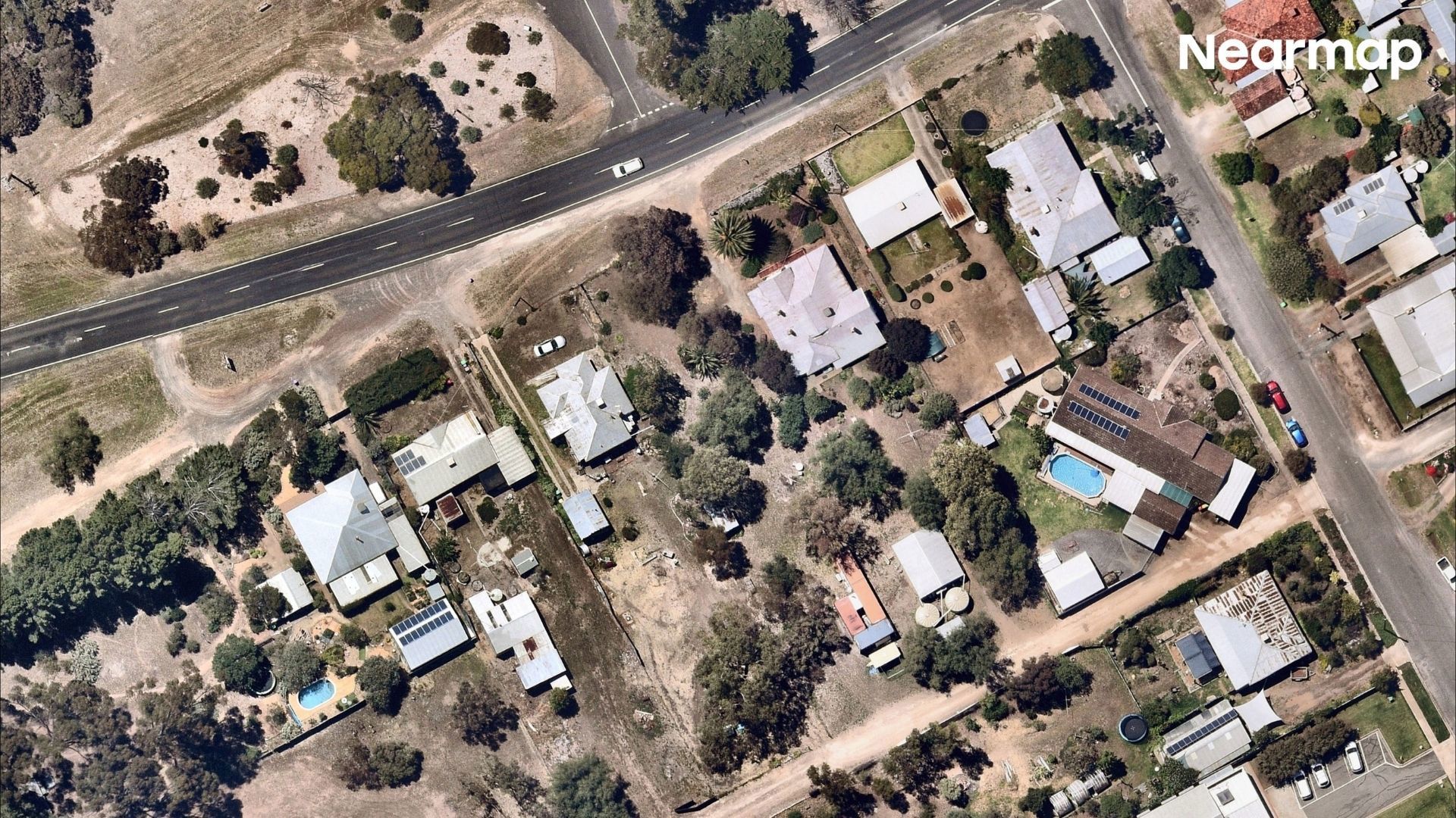
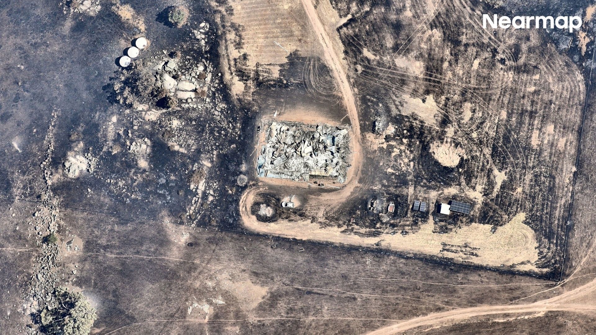
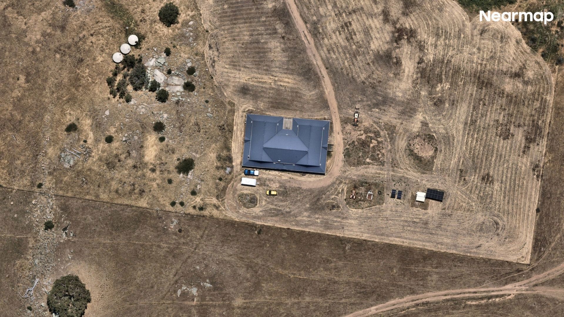
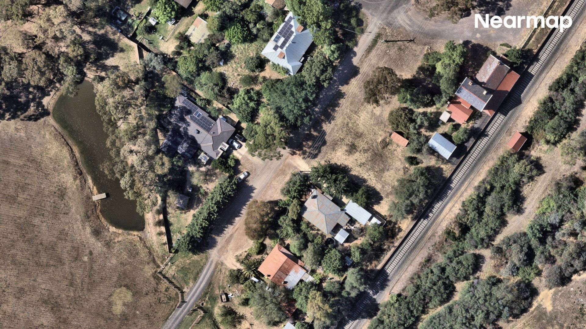
Striking aerial images from Nearmap reveal the drastic impact on properties in Natimuk and Harcourt, both before and after the intense fires swept through these areas.

In Natimuk, the infernos have led to the destruction of at least 30 homes, while in Harcourt and its vicinity, 54 homes have been lost to the flames.

Victoria Police are diligently investigating the origins of the major fires, including those in Ravenswood South and Walwa. Additionally, arson and explosives units are looking into the Longwood blaze.

In response to the devastation, nearly $200 million in aid has been pledged by federal and state authorities to assist the affected communities in their recovery efforts.
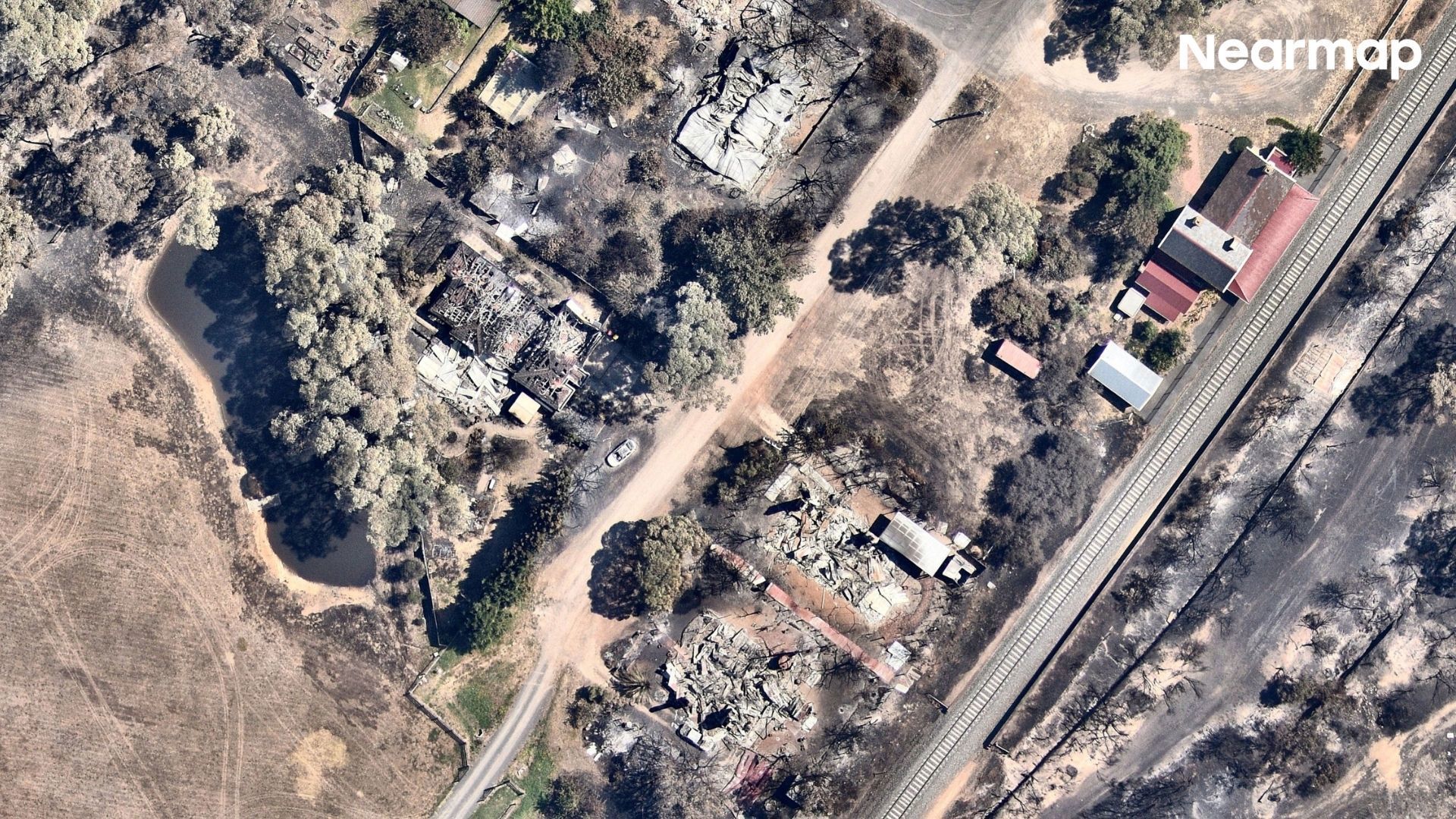
Harcourt on January 14, 2026.

Harcourt on December 29, 2025.

Harcourt on January 14, 2026. / Harcourt on December 29, 2025. (Property intelligence by Nearmap)
Natimuk on January 13, 2026.

Natimuk on December 9, 2025.

Natimuk on January 13, 2026. / Natimuk on December 9, 2025. (Property intelligence by Nearmap)
Harcourt on January 14, 2026.

Harcourt on December 29, 2025.

Harcourt on January 14, 2026. / Harcourt on December 29, 2025. (Property intelligence by Nearmap)
Natimuk on January 13, 2026.

Natimuk on December 9, 2025.

Natimuk on January 13, 2026. / Natimuk on December 9, 2025. (Property intelligence by Nearmap)
Harcourt on January 14, 2026.

Harcourt on December 29, 2025.

Harcourt on January 14, 2026. / Harcourt on December 29, 2025. (Property intelligence by Nearmap)
Harcourt on January 14, 2026.

Harcourt on December 29, 2025.

Harcourt on January 14, 2026. / Harcourt on December 29, 2025. (Property intelligence by Nearmap)

Images captured by Nearmap as part of property intelligence show the impact of the fires.

You May Also Like

Queen Elizabeth’s In-Flight Requests Revealed in New Report - Internewscast Journal

Queen Elizabeth’s In-Flight Requests Revealed in New Report

When a monarch takes to the skies, most would imagine a journey…