
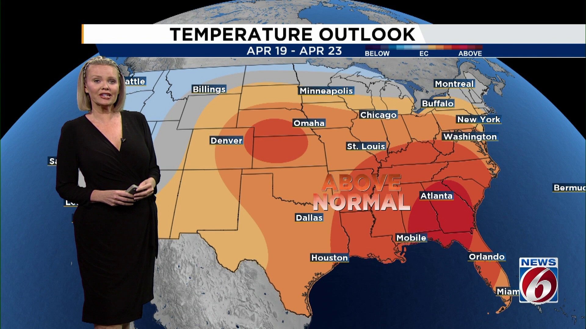
ORLANDO, Fla. – After enjoying a splendid weekend, Central Florida is poised for a warm and dry spell throughout the coming week.
This evening promises to be calm and pleasant, with clear skies enhancing the comfortable atmosphere. Tonight’s temperatures are expected to dip to a mild 63 degrees, setting the stage for a delightful start on Tuesday morning.
Thanks to a strong high-pressure system, the region will see little to no rain, allowing afternoon temperatures to steadily rise. Anticipate abundant sunshine through the middle of the week, with highs climbing into the upper 80s and possibly even higher as the weekend approaches.
As the weekend nears, some areas might experience temperatures soaring into the low 90s, significantly surpassing the average high of 83 degrees for this time of year.
This year, Orlando International Airport has recorded only three days of 90-degree temperatures, compared to five by this time last year. The upcoming heatwave might swiftly bridge this gap. Leesburg, in particular, stands a chance of setting a new high-temperature record on Saturday.
Despite the dry air keeping humidity levels in check, the rising temperatures will impart an early summer feel, rather than the typical mid-spring ambiance.
If you’re planning to spend time outdoors, it’s a great stretch for it—just remember to stay hydrated and take breaks during the warmest part of the afternoon.
Looking ahead, the pattern stays quiet with no major rainmakers in sight, meaning this dry stretch may continue into early next week.
Copyright 2026 by WKMG ClickOrlando – All rights reserved.