

Temperatures expected in the mid-upper 90s by week’s end.
ORLANDO, Fla. – Plenty of leftover moisture across Central Florida will help fuel another round of strong sea breeze storms Monday afternoon, before the pattern turns hotter and drier later in the week.
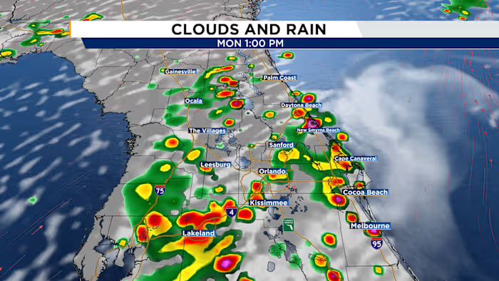
Monday will start off quiet for the morning drive, with a blend of sunshine and clouds. That early dryness will help temperatures climb back into the low to middle 90s, while feels-like temperatures rise above 100ºF. By the afternoon, the west coast sea breeze is expected to take the lead in triggering showers and storms.
Storms should first develop near I-75 between about 11 a.m. and noon. After 1 p.m., the best rain chances will push toward the I-4 corridor and areas farther east. By mid-afternoon into the evening commute, storms are likely to focus east of I-4 near the I-95 corridor before gradually winding down around sunset.
A change in the weather setup begins to take shape by midweek as two key factors move in: an upper-level ridge of high pressure and a plume of Saharan dust. Both will spread into Central Florida by Wednesday and remain in place through the end of the week, helping to suppress rain chances while driving temperatures higher.
By the end of the week, afternoon highs are expected to reach the mid to upper 90s, with heat index values climbing as high as 108ºF in some neighborhoods.