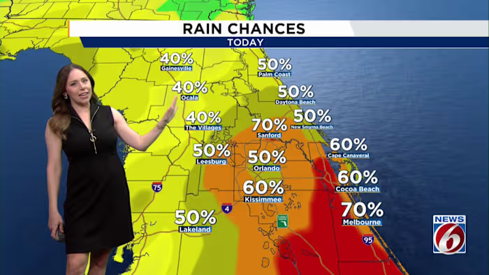


ORLANDO, Fla. – Central Florida is in for another classic summer day, with afternoon storms expected to pop up after temperatures rise into the low and mid-90s.
By later in the week, however, the weather pattern is expected to change. With fewer storms around to cool things down, temperatures will have more room to climb, increasing the potential for dangerous heat.
MONDAY
Showers and thunderstorms are forecast to build again Monday afternoon as the sea breezes from both coasts meet over the Florida peninsula. The highest rain chances, about 60% to 70%, are expected near and south of Seminole County.
As is often the case during the summer, some storms may turn strong, bringing frequent lightning, torrential rain and wind gusts of 45 to 55 mph. With storms moving slowly, localized downpours could quickly lead to minor flooding in low-lying spots and areas with poor drainage.
Afternoon highs will reach the low to mid-90s before storms develop. Warm, humid conditions will linger into the evening and overnight hours.
WEEK OUTLOOK
Rain chances will start to ease Tuesday as another plume of Saharan dust moves into the area. By Wednesday, only isolated showers and storms are expected, and Thursday may be mainly dry for many communities, with rain chances around 20% to 30%.
As the rain becomes less widespread, the heat will become the bigger concern. High pressure building over the Southeast will allow temperatures to climb into the mid and upper 90s across parts of the interior by the second half of the week.
With the hotter temperatures and Florida humidity, heat index values could approach or even exceed 108 degrees in some locations later this week. That means Heat Advisories may need to be issued.
WEEKEND
Rain chances are expected to gradually increase again by next weekend, but there is still some uncertainty on exactly when the deeper moisture returns.