The Atlantic hurricane season has entered an unusually quiet stretch — one of the calmest on record — as a powerful El Niño pattern suppresses storms before they can fully develop.
No Atlantic hurricane has formed so far this year, and the National Hurricane Center says conditions are unlikely to produce one for at least another week. That lull comes during what is typically the heart of the season, which officially runs from early June through the end of November and generally reaches its peak between August and October. So far, just five short-lived, relatively weak tropical storms have emerged.
Saturday marked a record for the latest point in a season without a storm reaching the 64-mph wind threshold required to become a hurricane, at least since the satellite era began, said Nick Novella, a meteorologist with the government’s Weather Prediction Center. A handful of seasons before the 1950s went this long without a recorded hurricane, but experts view those figures cautiously because ocean monitoring was incomplete at the time.
A broader measure of Atlantic hurricane activity — one that considers the number of storms, their intensity and their duration — is also at its lowest post-1950 level, according to Colorado State University hurricane specialist Phil Klotzbach. Activity is running at just 7% of the average for this point in the season. In its 2026 forecast, a Colorado State University research team projected that nine named storms would develop across the Atlantic basin.
Still, forecasters caution against becoming complacent. A single storm can cause widespread destruction even during an El Niño year. Experts often cite 1992, when the season began slowly before Hurricane Andrew struck with devastating force. Storms that never reach major-hurricane status can also bring deadly flooding, damaging winds and other serious hazards.
“It’s really staggering, just how inhospitable the Atlantic is to anything that could form a tropical cyclone right now,” said Kristen Corbosiero, an atmospheric science professor at the University at Albany. Developing systems are facing what she described as a “triple whammy”: powerful winds that rip them apart, dry air that deprives them of moisture and sinking air that suppresses their growth.
“It’s just hammering the Atlantic. It’s just impressive,” Klotzbach said, noting that the basin has not produced anything that has come particularly close to hurricane strength.
Strong El Niño winds stop storms
The most significant influence from El Niño is exceptionally strong wind shear. In this pattern, powerful easterly winds near the lower atmosphere move against stronger westerly winds higher up, disrupting the structure of developing storms. The opposing currents effectively “tear apart” tropical systems, Corbosiero said.
Across the main development region between Africa and the Caribbean — the zone where many of the Atlantic’s strongest hurricanes form before tracking west — wind shear is roughly 45 mph stronger than a tropical cyclone can typically tolerate, Corbosiero said. She called the intensity unprecedented.
“Their heads are cut off before they even have a chance,” said Brian McNoldy, a hurricane expert at the University of Miami.
The Gulf of Mexico is the notable exception, with wind shear remaining relatively limited there. Storms in that region often become more active later in the season, meaning the Gulf could still see powerful systems develop, Corbosiero and other experts warned.
Dry air is also draining moisture from developing storms, while African dust is further disrupting them. At the same time, fewer tropical disturbances — the potential “seeds” from which storms grow — are moving across the Atlantic. Experts say all of these conditions are typical effects of El Niño, compounded by high pressure over the Atlantic that forces air downward and makes storm formation even more difficult.
This is all despite warm waters — the world’s oceans have been record hot for 100 days — that normally feed storms. It shows the power of El Niño to overcome that, Klotzbach said.
The trouble is the Atlantic waters, while warm, haven’t warmed up nearly as quickly as the atmosphere above, which got hotter quickly as part of El Niño, said Massachusetts Institute of Technology meteorology professor Kerry Emanuel. His research found what matters more than just the water temperature is the difference in temperature between the air and the water. Because hurricanes are powered by the flow of heat from the ocean to the air. The higher that is, the less storm activity there will be.
The waters of the Atlantic are a few months behind the atmosphere in feeling the El Niño effect. But next year, as the El Niño winds down and cools closer to normal, the warm water will persist, which will increase the odds for next season to be extra busy, Emanuel said.
Stephen Lam/San Francisco Chronicle via Getty Images
Just as El Niño traditionally dampens Atlantic hurricane season, it tends to rev up tropical cyclone activity in the Pacific, with moist air and little wind shear. And so far this year, storm activity in the eastern Pacific is nearly double normal, with hurricanes lasting much longer than usual. In the central Pacific, activity is about 40% more than normal.
“It’s just a party out there, one right after the other in the eastern Pacific,” Klotzbach said.
While the Atlantic has had only five small tropical storms, there have been 16 named storms in the eastern Pacific and 20 in the central Pacific.
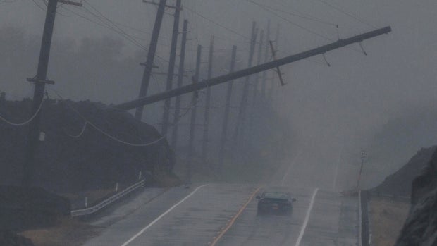
Hawaii has been hit twice. Hurricane Lowell pelted Hawaii’s western islands last week, causing widespread power outages on the island of Kauai. The small Kauai community of Hanalei reported 17.76 inches of rain. In August, Hurricane Lala — though it didn’t make landfall on the islands — caused widespread power outages and washed away about 100 homes. The Category 1 hurricane passed 30 miles off the Big Island’s coast, bringing torrential rains and wind gusts over 80 mph.
El Niño tends to push storms farther west than other years, Corbosiero said.
Because scientists have long known about El Niño’s effects on storm activity in both oceans, forecasters months ago predicted a slow Atlantic hurricane season.
“I don’t think anyone really foresaw it being this quiet,” McNoldy said. “This is quite remarkable.”