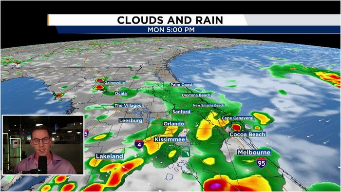

High chance for rain lingers early this week before a late-week cold front.
ORLANDO, Fla. – Monday
The workweek begins with unsettled weather as moisture and instability associated with a persistent upper-level low remain in place. Spotty showers will affect coastal areas and locations near the 95 corridor early Monday. Rain should shift east of I-95 around 10 to 11 a.m. Around lunchtime, showers and a few thunderstorms will develop along the I-4 corridor as the sea breeze moves inland. Storms will spread westward through the afternoon before weakening near sunset. High temperatures will reach the upper 80s.
Next Week
Rain chances will stay higher than usual through the middle of the week as the upper-level low continues to fuel instability through Wednesday. Forecast models are signaling the arrival of the first cold front of the fall season on Thursday. The front is expected to cross Central Florida early that day, bringing lower humidity and slightly cooler temperatures Friday and into the weekend. By Saturday morning, some areas could wake up to temperatures in the upper 60s.

The News 6 Weather team helps you stay informed about the day’s weather conditions.