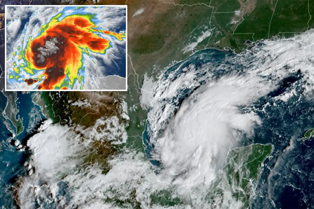

A highly unusual weather pattern is emerging across the United States this weekend, as tropical systems could affect the East and West coasts at nearly the same time.
In the Gulf of America, Isaias is strengthening and has become the first hurricane of the 2026 Atlantic hurricane season.
At the same time, the remnants of Hurricane Rachel are forecast to push a deep plume of tropical moisture into California and the Southwest, raising the threat of torrential rain and flooding.
If both threats unfold as expected, it would be only the third such East Coast-West Coast tropical setup since 1963.
The most recent example occurred on Sept. 6, 1972, when Tropical Depression Dawn affected the Atlantic side of the country while Post-Tropical Hyacinth brought impacts to the West.
A comparable pattern developed on Sept. 18, 1963. Tropical Storm Cindy struck the Atlantic side, while Tropical Depression Jen-Kath affected the Pacific side.
More than 50 years later, forecasters are watching the potential return of this rare “tale of two coasts.”
Isaias is poised to bring direct tropical weather to the Gulf Coast, while Rachel’s remnants may transport a substantial amount of tropical moisture into the western United States.
DISCOVER MORE: Ex-Corrections Officer Accused of Killing Wife, Forcing Kids to Help
The systems are not expected to interact directly. Even so, their overlapping effects could produce an exceptionally unusual national weather pattern.
Isaias developed in the Bay of Campeche and is forecast to intensify while tracking north toward the Gulf Coast.
Hurricane and Storm Surge Warnings are in effect for parts of the northern Gulf Coast as the storm becomes better organized and continues to strengthen.
The current forecast calls for Isaias to reach the coast late Friday or early Saturday somewhere between Gulfport, Mississippi, and Panama City, Florida.
Tropical rain may begin moving into the Gulf Coast as soon as Friday morning, before the storm speeds up on its approach later in the day.
Forecasters warn that Isaias could produce torrential rain, damaging wind gusts, potentially life-threatening storm surge and tornadoes as it moves inland.
The NOAA Weather Prediction Center has placed parts of Louisiana, Mississippi, Alabama, Florida and Georgia, as well as southern Tennessee, southwestern North Carolina and western South Carolina, under a flash flood risk for Friday.
A Level 3 of 4 flash flood risk is in place for Mobile, Alabama, and the Florida Panhandle west of Panama City. Atlanta and Montgomery, Alabama, are included in a Level 2 risk. By Saturday, the threat is expected to shift inland toward the Carolinas and the Tennessee Valley.
The NOAA Storm Prediction Center has also issued a Level 2 of 5 severe-weather risk for southern Alabama and the Florida Panhandle on Saturday. Tornadoes are considered one of the main dangers as Isaias’ outer rainbands move ashore.


