
Share this @internewscast.com
A spell of splendid, dry weather is on the horizon, as a consistent warming trend is poised to push temperatures close to record levels later in the week.
Sunday
By Sunday, a brisk easterly breeze will dominate the region, courtesy of a high-pressure system strengthening along the East Coast. This atmospheric setup promises another day of gusty winds with minimal chances of rain.
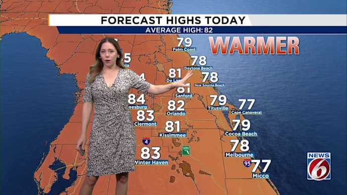
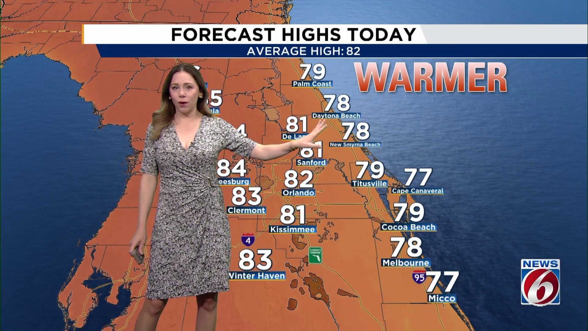
Throughout the afternoon, expect wind speeds to climb to 15 to 20 mph, with occasional gusts reaching up to 30 mph. Meanwhile, temperatures will remain close to the seasonal average, ranging from the upper 70s along the coast to the low 80s inland.
Marine Hazards
The primary concern in the forecast centers around the coastline, particularly for beach enthusiasts and boaters looking to enjoy the water.
A High Risk of rip currents persists today and into the early part of the week, accompanied by rough surf conditions.
Boating conditions remain challenging, with seas ranging from 5 to 7 feet. A Small Craft Advisory is in effect for offshore areas, and even nearshore waters will remain turbulent. However, conditions are expected to gradually improve by Tuesday as winds and seas begin to calm.
Next Week
High pressure stays firmly in control through the workweek, keeping conditions warm and very dry.
As winds die down through the week, temperatures are expected to climb quickly.
By the start of the week, temperatures should hold in the low 80s along the coast mid 80s inland through midweek.
By late week and into next weekend, temperatures climb even higher with highs nearing 90 and approaching records for some.