Share this @internewscast.com
TAMPA, Fla. (WFLA) — Another day with frequent passing downpours is expected with a 50% overall rain chance.

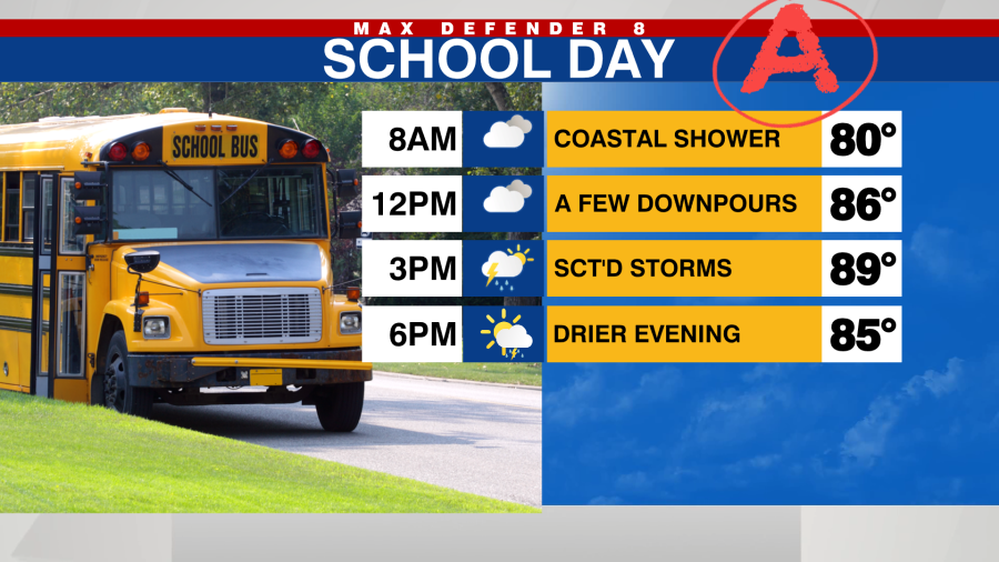
Downpours will increase in coverage through the morning and into the afternoon before drying out this evening.

Dryer air is set to move into the Tampa Bay region, particularly north of I-4, by Wednesday. As a result, the likelihood of rain will drop to just 20% for a few isolated showers. With fewer showers and more sunshine, temperatures will rise to the low 90s.
Tropical moisture will quickly stream back in starting Thursday leading to afternoon storms that drift inland.

Rain chances are expected to increase over the weekend as tropical moisture accumulates, leading to frequent passing downpours that can occur at any time of day.

Currently, tropical activity has calmed down. Tropical Storm Fernand remains in the central Atlantic and is expected to move north today before dissipating. There will probably be a pause in activity over the next week, with conditions becoming more active again by mid-September.