
Share this @internewscast.com
ORLANDO, Fla. – Central Florida is waking up to a dense fog advisory this Monday morning, as a thick layer of fog reduces visibility across the area to under a quarter-mile.
As the morning progresses, the sun is expected to break through, gradually dispersing the fog and thinning out the cloud cover, particularly north of Orlando.
Although most of the region will remain dry, a minor offshore disturbance has the potential to trigger a few brief showers over the Atlantic. There is a slight chance that one of these showers could make its way to the coastline.
[VIDEO BELOW: Tips for Driving in Fog]
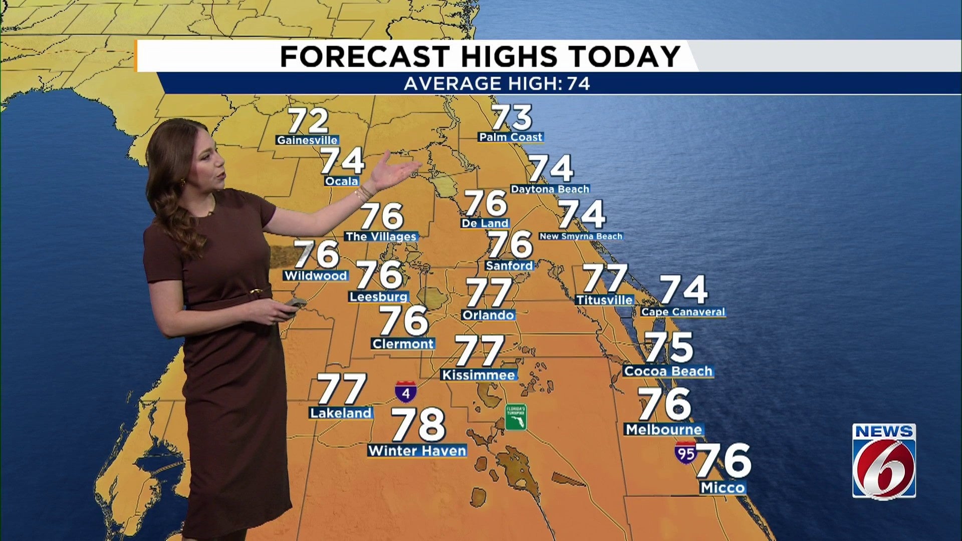
Afternoon temperatures are set to rise comfortably, reaching into the mid- to upper 70s.
As night falls, conditions will remain calm, though patchy fog is expected to form once again, especially in inland areas away from the coast.
This Week
From Tuesday through Friday, high pressure remains firmly in place, bringing classic warm and dry Florida weather.
After any early morning fog burns off, expect mostly sunny to partly cloudy skies each day.
[VIDEO BELOW: How to get most of free News 6 Weather App]
Afternoon highs will run well above normal for early January, reaching the upper 70s to low 80s area-wide.
By Friday, some interior spots could push toward the mid-80s, and places like Orlando and Leesburg may even flirt with record-highs.
Weekend
A stronger weather system is expected to move into the eastern U.S., sending a cold front toward Florida sometime late Saturday or Sunday.
At this point, rain chances look low but a noticeable cooldown appears more likely by Sunday into Monday.
Looking to early next week, temperatures should trend cooler, though just how cold it gets remains up in the air.
Stay tuned.
Copyright 2026 by WKMG ClickOrlando – All rights reserved.