
Share this @internewscast.com

ORLANDO, Fla. – After a stormy and sweltering week across Central Florida, an unsettled weather pattern isn’t letting up just yet.
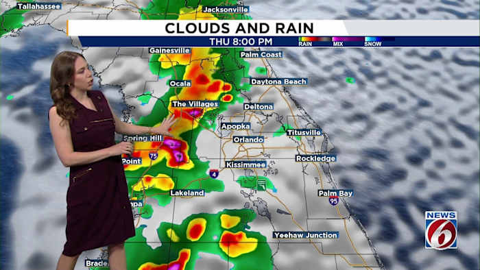
Thursday
Deep tropical moisture continues to hang over the region, fueling widespread showers and storms Thursday afternoon, especially inland.
The most intense storms are anticipated to occur west of I-95, where there is a risk of frequent lightning, strong winds reaching up to 55 mph, and heavy rainfall leading to minor flooding in low-lying areas. While coastal regions experience initial storm activity, the main focus shifts inland as the day progresses.
Highs will climb into the upper 80s to low 90s, with heat index values soaring as high as 108 degrees.
Friday- Weekend
A stalled frontal boundary to the north and persistent moisture from a nearby tropical wave will keep daily storm chances high into the weekend.
Each afternoon, a broad area can expect showers and storms, with the most severe conditions forming inland, although they begin along the coast in the morning hours.
Rainfall likelihood will be at its highest, reaching 70–80% each afternoon. These strong storms may bring heavy rain, localized flooding, and dangerous lightning.
The cloudiness and consistent rain will aid in moderating temperatures, keeping highs around the upper 80s to low 90s, with the heat index reaching the 100s.
Back to School
The weather remains hot, humid and stormy into early next week, though rain chances may dip slightly to around 50–60%.
Coastal areas will likely see morning and early afternoon showers, with storm activity shifting inland later in the day.
Slightly less cloud cover may allow temperatures to rise a bit, with highs creeping into the low to mid-90s by midweek.
Copyright 2025 by WKMG ClickOrlando – All rights reserved.