Share this @internewscast.com
ORLANDO, Fla. – A brisk cold front swiftly moved through the area tonight, shifting the winds to the north and introducing a noticeable chill in the evening air.
By tomorrow morning, this chill will intensify, especially in our northwestern counties, where temperatures could feel like they’re dipping into the mid to upper twenties.
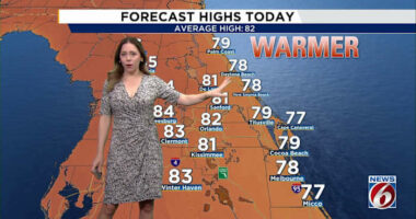
For most residents, however, despite the gusty winds, temperatures are expected to remain in the upper 40s to low 50s, particularly around the Orlando metro area and further southeast.
It’s wise to layer up, as wind gusts may reach between 15-25 mph in certain areas. Urban structures could channel these winds and enhance the chill, so prepare accordingly for Monday morning.
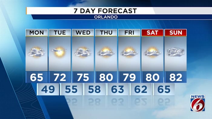
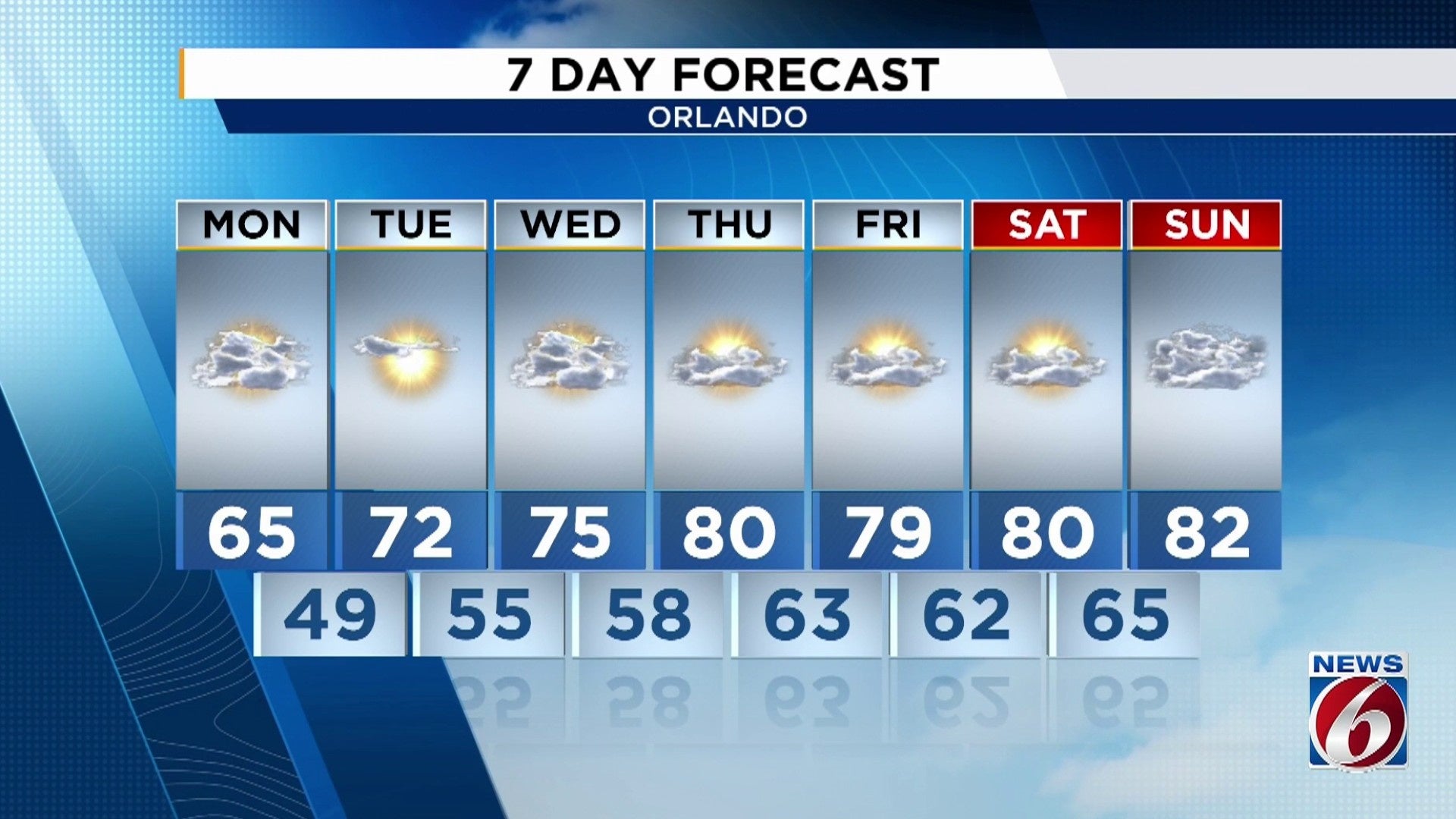
On Tuesday, the cold air mass will still hover over Florida, though it will begin to recede quickly.
Morning lows are projected to be in the lower 40s for places like Alachua, Marion, and the upper parts of Lake and Sumter counties. The coldest temperatures will likely be experienced northwest of the I-4 corridor in Central Florida.
While we won’t be pleasant, we certainly won’t be anywhere near the freezing point in the four corners counties or up the Atlantic coast from Brevard through to Flagler county.
Then moving into Wednesday, Florida is back in business. Temperatures are likely to swing back upwards with high’s back in the low 70’s across the board making for rather pleasant conditions during the day from Wednesday to Friday.
From here, the warmth looks to stick around. Stubborn warmth at that.
Computer models show the development of a fairly strong and dominant subtropical ridge which will drive our temperatures up into above average territory. We could still see these warm days through the calendar start of winter and Christmas.
As the ridge remains in control we’re going to see temperatures stay on the higher side, with the staple Florida humidity in play alongside it.
To combine with these warmer than average afternoon temps, rain will be scarce. In all honesty, I can’t really pinpoint any significant weather players to change things up for all of us over the next 10-14 days. Warm, mild, and humid are likely to remain the weather buzz words for the Central Florida area as we move through the second half of December.
If things continue on this current trend, we may even wrap up 2025 altogether on a warm note.
Copyright 2025 by WKMG ClickOrlando – All rights reserved.