
Share this @internewscast.com

If you’ve been appreciating the recent stretch of sunny days and less rain across Central Florida, you’ll be pleased to hear that this weather pattern is set to continue into Tuesday.
But don’t put the umbrella away just yet.
Next few days
A robust ridge of high pressure is present both at the surface level and higher up, effectively keeping the likelihood of rain on the lower side.
[VIDEO BELOW: New AI model yet another forecasting tool]
Most areas across east Central Florida will stay dry, as slightly drier air moves in.
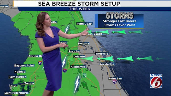
However, it’s important to note that we won’t entirely escape storms, as there remains a moderate chance (30-40%) of storms occurring in the evening when sea breezes meet over the western areas.
Stronger storms could produce downpours, lighting and gusty winds.
With less rain around, the temperatures will soar in the Orlando area.
Highs will top out in the low to mid-90s, especially across inland areas, with heat indices up to 105 degrees Tuesday.
[VIDEO FROM MAY: Lightning sparks Seminole County house fire]
Looking ahead
A slight uptick in rain chances begins Friday (the first official day of summer) as moisture creeps back in with coverage at 50-60%.
By the weekend and into early next week, another ridge builds back in, keeping temperatures hot and afternoon storm chances in the 40%–50% range.
Copyright 2025 by WKMG ClickOrlando – All rights reserved.