Share this @internewscast.com
TAMPA, Fla. (WFLA) — Drier air has moved into regions along and north of I-4, creating a relatively comfortable morning in Citrus and Hernando County, while the rest of us are still experiencing mild temperatures and humidity.
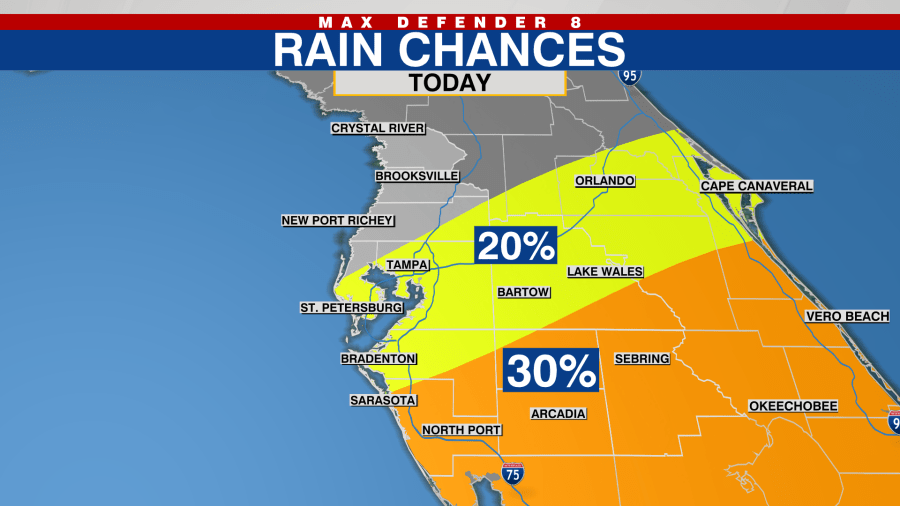
The drier air will continue to spread southward, resulting in lower rain chances today and more sunshine for areas along and north of I-4. Regions like Hillsborough, Polk, and Pinellas, along with points further north, will see more sunshine and experience warmer temperatures, with highs reaching the mid-90s for the first time since last week.

Areas south of I-4 will see some spotty showers and a good amount of cloud cover.
Most locations will remain dry tonight, enjoying relatively comfortable temperatures. Thursday will begin nicely, with sunshine returning for everyone in the afternoon, bringing hotter conditions and highs in the mid-90s.

Rain chances will rise to 30 to 40% with the normal summer afternoon thunderstorms that move inland through the evening. A similar weather pattern is expected on Friday, albeit with slightly better coverage of afternoon storms.
Tropical moisture will return over the weekend, increasing rain chances again. Showers and storms will be plentiful, particularly on Saturday afternoons.

Rain chances will further escalate on Sunday, with passing downpours possible throughout the second half of the weekend, reaching a 70% chance. Unfortunately, this soggy pattern persists into Labor Day, with rain chances still at 70% and downpours possible at any time.
Temperatures will come down into the upper 80s close to 90 as rain chances go up this weekend.
Slightly drier conditions will return for the middle of next week.
The tropics are much quieter with Tropical Storm Fernand moving into the northern Atlantic and remains no threat to land.

New tropical development is not expected over the next 7 days with a lull in the activity expected through the end of next week. After that, the tropics will likely reawaken again in mid-September.