
Share this @internewscast.com
We can now confidently state that Hurricane Erin is nearing its end. Since Thursday, it has begun shifting from a well-formed tropical system to a more diffuse area of low pressure. While this may suggest a weakening, significant coastal effects will persist, albeit far from us in Central Florida.
As we bid farewell to the hurricane that defined August, our focus quickly shifts to the next development in the Atlantic basin.
The National Hurricane Center identified Invest 90L on Thursday, and as predicted, the likelihood of its formation has steadily increased since then.
According to the 8 a.m. update from the NHC, there is now an 80% chance of development in the next two days, and a nearly 90% chance over the next seven days. Their discussion notes that a tropical depression could emerge at any moment.
Forecast models consistently suggest that these clusters of showers and storms will develop into a tropical storm. Although the satellite view isn’t particularly striking, the evident rotation in wind patterns indicates the early formation of a low-pressure center.
By Saturday, if not the latest Sunday, pending how the pocket of energy fares through the day Friday, I fully anticipate Fernand to be designated.
The key takeaway here is that Erin’s gradual movement has created a path in our Atlantic high-pressure pattern, allowing this impending storm to safely move out to sea.
It should not influence the weather in our island neighbors of the Caribbean as much as Erin did either, because of this northward turn. It will move north and eventually back eastward much faster than Erin did.
Bermuda, however, could be in for some sporty weather as it approaches from the south.
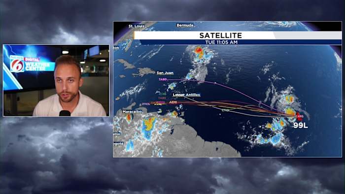
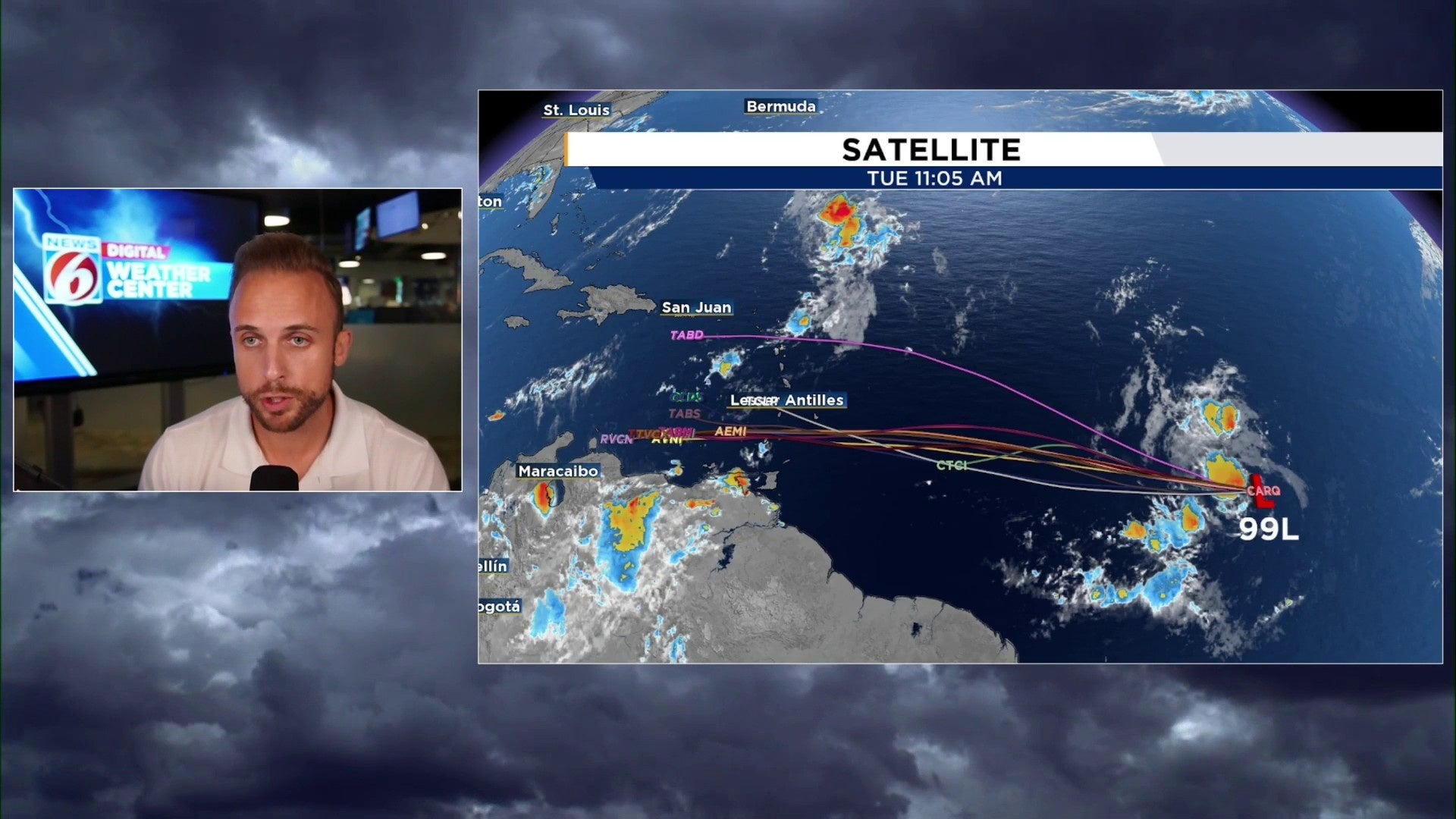
I also want to briefly touch on 99L back behind 90L (I know, I know, there’s L’s and numbers flying around everywhere. That’s peak season for ya!)
While computer models are not jazzed about this second tropical disturbance at all, the trends have been very interesting to watch. This is a system that was supposed to have “poofed” this past Wednesday.
Yet it continues to hold its own as it works westward through the tropical Atlantic. Dry air does seem to be getting a hold of it today, as well as some upper-level wind shear helping to pick apart the once more organized clouds and storms.
But the National Hurricane Center has extended the formation zone a bit further westward towards the Lesser Antilles. If a weak batch of clouds and moisture can persist, the more it meanders into the Caribbean, it will find a better environment to maybe throw a Hail Mary down the field before August finishes up.
It’s a low potential for now, and we have several days to watch as it continues its voyage. But just something I wanted everyone to keep on their radar!
Copyright 2025 by WKMG ClickOrlando – All rights reserved.