
Share this @internewscast.com
ORLANDO, Fla. – If you’ve been stepping outside and thinking, “Didn’t we just have this weather yesterday?” you’re not wrong.
We’re in a pretty consistent weather pattern in the Orlando area, and it’s going to stick around a bit longer.
Here’s a quick breakdown of what to expect as we move through the week.
Temperatures
We’re looking at another hot and humid day Monday across east Central Florida.
Temperatures are set to rise into the upper 80s and mid-90s, with the heat index reaching between 100 and 105 degrees. This places us in a Moderate to Major Heat Risk category, particularly in the Orlando area. If you’re spending time outdoors for work or leisure, it’s important to take regular breaks, stay hydrated, and seek shade or air conditioning.
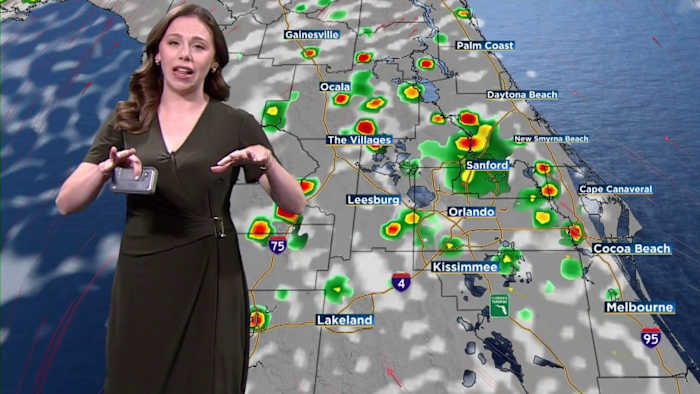
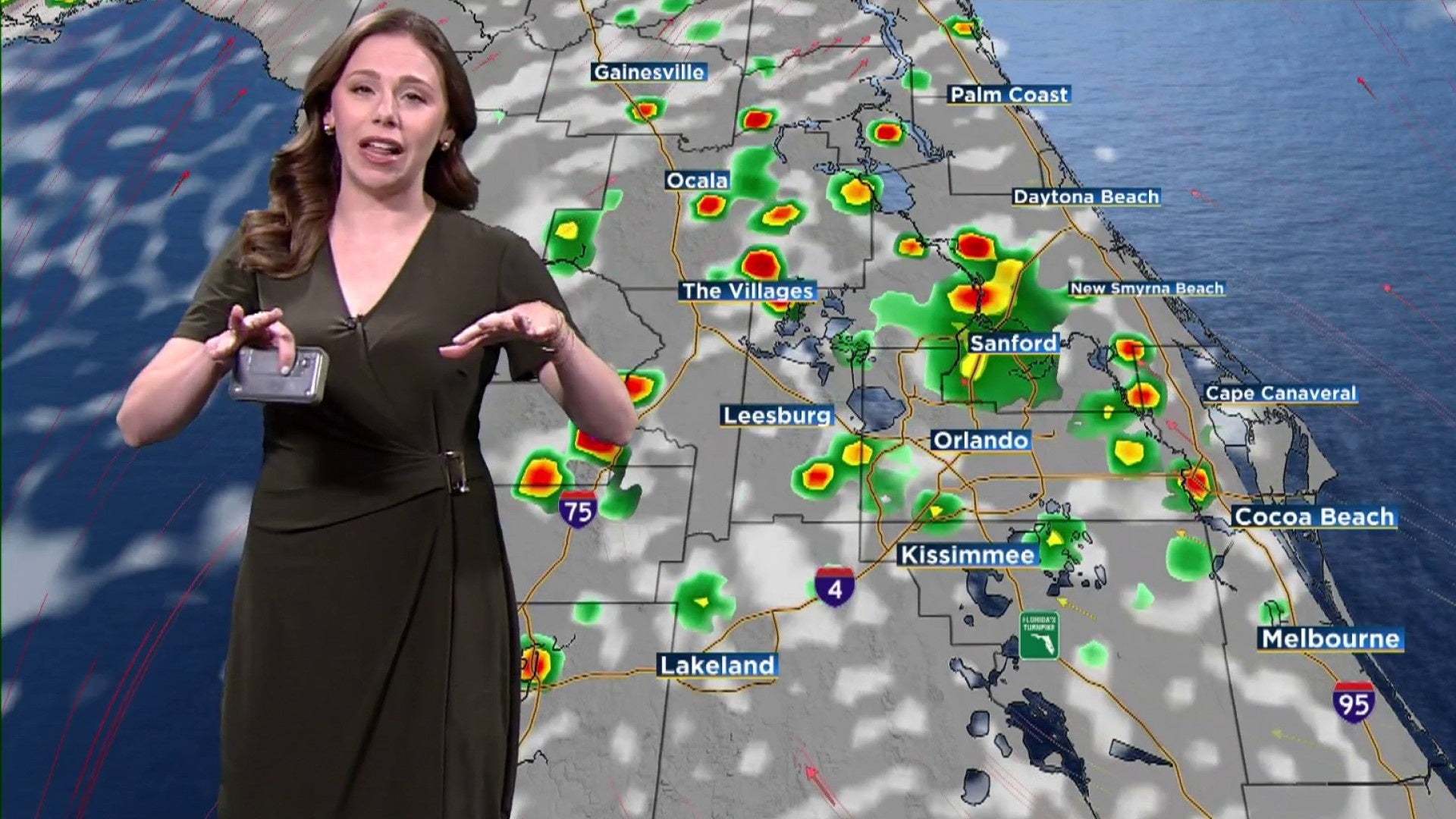
Rain & storm chances
Most of the region will stay dry during the first half of the day.
Drier air is moving into areas south of a Kissimmee-to-Melbourne line, so rain chances there are slim at 20%.
To the north of I-4, moisture will persist, heightening the likelihood of scattered showers and storms later on Monday, predominantly between late afternoon and evening when sea breezes from both coastlines intersect. The chance of rain in these regions increases to 40–50%.
Storms, if they form, aren’t expected to be severe, but they could pack a punch with:
-
Frequent lightning
-
Wind gusts up to 50 mph
-
Heavy rain that could drop 1–3 inches in some spots, possibly leading to minor flooding in poor drainage areas.
Looking ahead
The overall pattern won’t change much through midweek as a large ridge of high pressure remains over Florida.
By Friday and into the weekend, a weakening front could add additional moisture to the area.
Model uncertainty remains for this timeframe, so we will be keeping rain chances seasonal at 50-60% for now.
Copyright 2025 by WKMG ClickOrlando – All rights reserved.