
Share this @internewscast.com

ORLANDO, Fla. – After days of heavy rain and flooding issues, much needed drier weather arrives arrives in Central Florida this weekend.
On Thursday and Friday, scattered downpours and thunderstorms will persist in regions south of Orlando due to lingering tropical moisture that is slow to dissipate. Some storms may lead to locally heavy rain, with 2–4 inches possible in specific areas and isolated higher amounts.
Minor flooding remains a concern, especially in spots that have already been soaked this week.
A Marginal Risk (Level 1/5) for excessive rainfall remains on Friday, particularly south of Cape Canaveral, with some areas facing a Slight Risk by Saturday.
For the rest of Central Florida, much drier weather starts Thursday and Friday, with rain coverage at 20-30%.
Despite the rain, temperatures will stay close to normal for mid-September. Highs will generally be in the mid- to upper 80s.
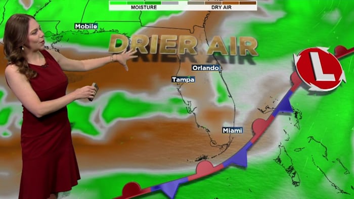
Looking ahead, drier air is anticipated to gradually enter the region by late Saturday and into Sunday, finally providing some relief from the daily rainfall.
Rain chances drop significantly into early next week, setting the stage for a much nice and more comfortable stretch of weather.
Copyright 2025 by WKMG ClickOrlando – All rights reserved.