
Share this @internewscast.com

ORLANDO, Fla. – As of Sunday morning, chances for formation are already climbing for a feature off the immediate shores of the Carolinas.
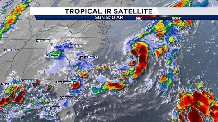
Newly-designated Invest 95L is slowly organizing and could take on our next named storm of Dexter.
Satellite images reveal a robust low-pressure system forming strong thunderstorms near its center, indicating it’s organizing effectively.
This new circulation was triggered by the same frontal boundary that recently affected Central Florida. The tail end of this front stretches across northern Florida, significantly increasing rain possibilities.
The National Weather Service has issued a flood watch for parts of northern Florida and Georgia, as this front is expected to remain stationary over the next day.
The center pieces of that front are sitting right over the warmest waters of our Atlantic. As a result, a low-pressure center quickly developed.
The good news?
This front, which contributed to the formation of a potential tropical system, also prevents it from moving westward. The predicted course directs it northeast into open waters, posing no threat except possibly affecting fishing and boating in the North Atlantic.
The National Hurricane Center is steadily upping the probabilities of development, placing it at 50% within two days and another 50% within the week, with expectations for these chances to rise.
A similar situation is forecast for a large area of interest tied to a tropical wave expected to emerge off Africa’s west coast by Monday night into Tuesday.
Chances are up to 30% this forms over the next seven days with good model agreement we’ll see organization that far to our east.
Recent trends have been promising, showing an escape path for the developing wave out into the central Atlantic away from any close pass to the United States, let alone Central Florida.
Copyright 2025 by WKMG ClickOrlando – All rights reserved.