
ORLANDO, Fla. – The 2025 hurricane season is officially underway.
Even though there’s been some reduction in activity in the tropical Atlantic, meteorological authorities continue to predict a lively season, with an expectation of 13-18 possible storms forming throughout the period.
While we have examined the figures offered by pre-season forecasts, the real question is about their potential paths. The major concern isn’t the quantity of storms, but rather their trajectories and which areas might be affected.
At News 6, our team has meticulously analyzed all available data to formulate a tentative prediction regarding regions that should remain particularly vigilant once the initial storm emerges.
Meteorologist Jonathan Kegges and I broke down a plethora of climate model data, as well as looked at trends through the years which we call “analogs.”
An analog in its simplest definition is just a season in the past that had similar conditions to what’s in place currently across not only the Atlantic, but the entire northern hemisphere. It’s kind of a cheat sheet, if you will, to help give us a better understanding of what to expect once the hurricane season does get underway and storms begin forming.
I also want to squash a common misconception we see floating around YouTube and other social media platforms. Analog years don’t really have much to do with the number of storms that we could observe during the latest season. It’s very easy to imagine to take the statement “2020 is an analog year,” and immediately develop the idea we’re going to see 30 some-odd-named storms.
No, in fact, analog years have almost zero connection to the total number of storms that formed during that specific hurricane season. It’s actually a look at variables like the ENSO, whether we were El Niño or La Niña, what our Bermuda-Azores high looked like during parts of that calendar year, what ocean temperatures were like, comparing hot and cold spots.
Analog years give us meteorologists a way to look back in history at what general weather conditions were doing at a point in time, and what encouraged storms to behave or travel in the fashion that they did.
But! Now that we’ve concluded your crash course on analogs, let’s break down THIS hurricane season.
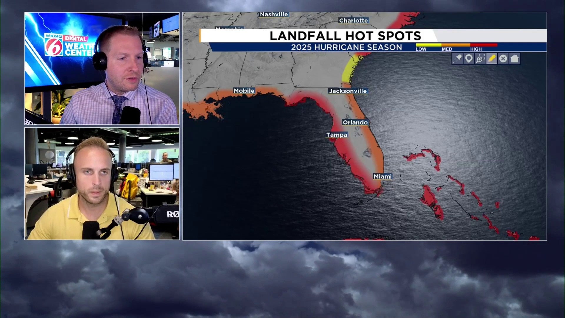
Right away we want to EMPHASIZE – IF your area is not highlighted for a moderate or high risk, it does NOT mean you will not see any tropical impacts at all. We want to make that very clear as to not miscommunicate our message. The areas designated as a “low” threat potential, does not indicate a non-zero chance of a sneaky storm trying to head your way.
So while we may not have highlighted your particular area as a higher than normal risk zone for a landfall, we are not saying there’s no chance of a threat.
Conversely, just because there is a higher risk doesn’t guarantee impacts.
Our mapping simply highlights where we believe we have a greater shot at seeing these storms track. Earlier and later into the season it becomes increasingly difficult to forecast a landfall because we have so many different mechanisms in play steering them.
Florida Threat Level
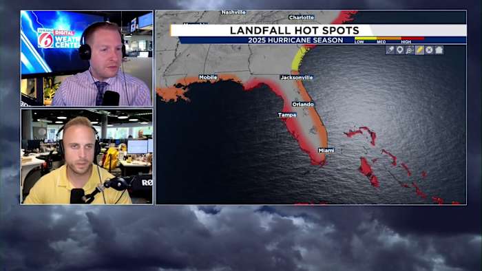
From a Florida perspective, the Gulf Coast of Florida has a higher-than normal chance of being impacted by a tropical system.
The east coast of the Sunshine State will also want to be on guard. A common storm track in 2025 looks to have storms move near/around the Bahamas and close to Florida. Depending upon the steering currents at the time of the storm will determine if it moves safely out to sea or closer to Florida.
2025 Driving Forces
You’ve probably already heard the Atlantic is FINALLY no longer sitting at well above-record warm temperatures. During 2023 and much of 2024, the tropical Atlantic was on average 2-4 degrees Celsius warmer than the norm.
As a result, tropical weather organizations were predicting a hyperactive season with 20+ named storms. This year the Atlantic is a bit more tame. But we do have warm waters loaded up close to home, with coastal waters along the Gulf Coast of Central and South Florida reaching upward of 90 degrees Fahrenheit!
So while the part of the basin where most tropical waves move east to west off Africa has cooled down, it doesn’t mean the water is cold. This matters because it influences wind and pressure patterns across the ocean. Ocean temperatures play an absolutely pivotal role in the way our atmosphere behaves.
Usually, hot water tends to reduce areas of higher pressure. 2023 was symbolic of this with a suppressed and weakened Bermuda high. That’s why around 90% of the 20 named storms that formed were far away from any major landmass curving out to sea. El Niño also plays a role in this.
Last year, the water temperatures were warmest in the tropics themselves. We also transitioned from El Niño to a modest La Niña on the backend of the peak season. So we saw a lot of development close to home and impactful storms.
This year, we’re most likely going to be in neither an El Niño or La Niña. Which means what happens in the Atlantic is far more determined by how the weather acts from North America to Europe and Africa. Things like troughs, ridges, high and low pressures, wind speeds and direction, will play a larger role than the basin receiving an extra nudge of support thanks to La Niña.
We’re also thinking the Atlantic high pressure will be fairly dynamic. Some storms will be allowed to escape out to sea. But because of the warmest waters being loaded up and squished against the Gulf Coast and the southeast/Mid Atlantic shores, we should monitor for close to home developers.
Also, thanks to the warm waters off the southeast and Mid-Atlantic coast, and the volatility we may see in the Bermuda-Azores high, Georgia, but especially the Carolinas up to Virginia could see some very close shaves or perhaps a direct hit from a recurving storm if it doesn’t get kicked out to sea sooner than later.
The cool neutral will be something to focus on as well. We believe that’s the “kicker” for us Floridians. Statistics show landfalling storms tend to favor either travelling within close range of our state, or scraping across entirely thanks to the way our large-scale weather pattern is arranged.
Model projections for the Fall season also suggest we could have anomalously strong (stronger than typical) high pressure ridging built up over the northeast and Atlantic Canada. This COULD drive storms up against the Central Florida east coast, or perhaps end our landfall drought knocking a system west into the peninsula.
Copyright 2025 by WKMG ClickOrlando – All rights reserved.