Share this @internewscast.com

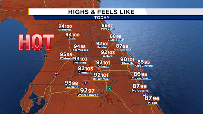
ORLANDO, Fla. – Another hot day is expected across Central Florida.
[WATCH VIDEO FORECAST BELOW | FIND THE LATEST WEATHER ALERTS IN YOUR AREA BY CLICKING HERE]
Highs will reach the low 90s inland and upper 80s near the coast, but it will feel more like the triple digits.
There’s also a marginal risk of severe weather for all of Central Florida today.
[EXCLUSIVE: Become a News 6 Insider (it’s FREE) | PINIT! Share your photos]
Isolated storms may occur from 1 p.m. to 10 p.m., with the potential for some to reach strong to severe levels. The primary risks include lightning, small to medium-sized hail, and wind gusts reaching up to 60 mph.
On Saturday, viewers shared incredible pictures and videos of severe storms in their area.
[WATCH: Storms send tree onto Palm Bay home; hail reported across Central Florida]
You can send in your own storm photos and videos at ClickOrlando.com/Pins. We may feature them on air or online!
Tonight will be quieter and dry, with lows in the 70s.
Memorial Day will start off warm, muggy and dry, but rain chances rise to 40% in the afternoon, so keep rain gear handy.
The rest of the week stays hot, with daily highs in the low 90s and rain chances between 50–60%.
Copyright 2025 by WKMG ClickOrlando – All rights reserved.