
Share this @internewscast.com

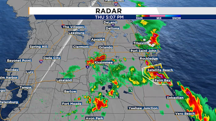
ORLANDO, FL – A Severe Thunderstorm Warning that was in effect for southeastern Marion County through 7:30 p.m. has expired.
Severe thunderstorm conditions represent a serious threat, with the potential for significant property damage and a danger to life.
Take Immediate Action:
-
Stay indoors and away from windows.
-
Do not drive unless absolutely necessary.
-
Keep an eye on local weather alerts for updates.
Stay safe and remain sheltered until the storm has passed.
THE FORECAST
Anticipate that the stormy conditions will persist into the evening, gradually clearing later in the night. While the majority of storms should be finished by 8 p.m., there could be some lingering showers for a while longer.
Lows tonight will settle in the mid 70s under cloudy skies.
Tomorrow starts off dry and sunny heating up to the low 90s once again while feeling like the triple digits.
Expect storms to fire up in the second half of the afternoon and linger through much of the evening.
From Monday onward, Central Florida can expect highs in the upper 80s and frequent rain, as the unsettled pattern lingers through the week.
Copyright 2025 by WKMG ClickOrlando – All rights reserved.