
Share this @internewscast.com
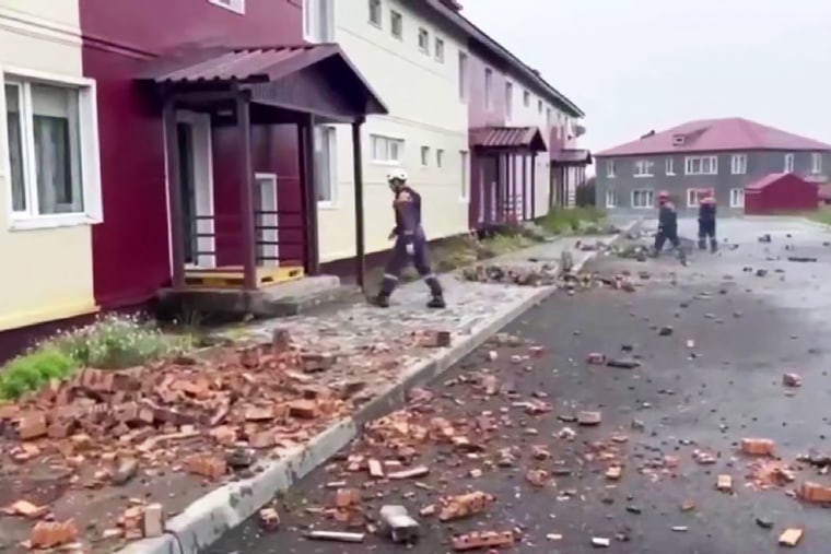
An earthquake with a magnitude of 8.8 occurred off the coast of Russia’s Kamchatka peninsula, propelling a wave of water as fast as a jetliner toward Hawaii, California, and Washington state, causing warnings and concern overnight on Wednesday.
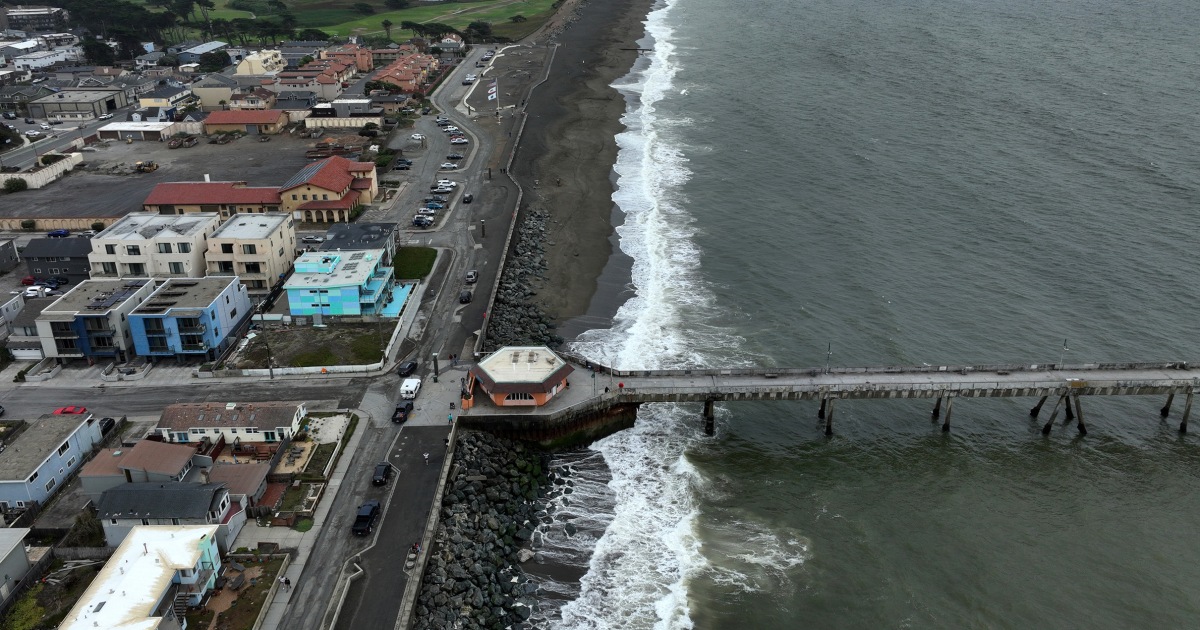
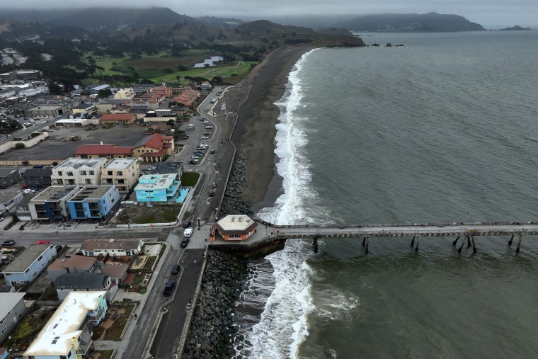
However, when the tsunami waves reached the U.S., they didn’t result in destruction or fatalities, and in some areas where warnings had been issued, the flooding might not have seemed alarming.
That doesn’t mean the tsunami was a “bust,” that it was poorly forecast or that it didn’t pose a risk, earthquake and tsunami researchers said.
“Once people hear a tsunami warning, they often recall the last Hollywood film they saw, then it arrives at 3 feet, leading people to ask, ‘What’s that?’” explained Harold Tobin, the director of the Pacific Northwest Seismic Network and a University of Washington professor. “We should see it positively that a tsunami happened, we were warned, and it wasn’t a worst-case situation.”
Here’s what to know.
How strong was the Kamchatka earthquake? And why did it change so much?
The United States Geological Survey’s initial reports described the Kamchatka earthquake as an 8.0-magnitude event, which was later revised to an 8.8 magnitude.
“This is not unusual for extremely large earthquakes in those first moments,” Tobin noted. “Our usual algorithms for quickly calculating an earthquake’s size often reach their limits. It’s like turning up an amp and getting a lot of distortion.”
An early indication that the earthquake was stronger than initially reported came from a buoy approximately 275 miles southeast of the Kamchatka peninsula.
The buoy, which is part of the National Oceanographic and Atmospheric ministration’s DART (Deep-ocean Assessment and Reporting of Tsunamis) system, is connected to a seafloor pressure sensor about 4 miles below the surface.
The sensor registered a 90-centimeter wave, which is eye-popping to tsunami researchers.
“That’s the second-largest recording we ever saw in the tsunami world,” said Vasily Titov, a senior tsunami modeler at NOAA’s Pacific Marine Environmental Laboratory, adding that it indicated there was “a catastrophic tsunami propagating in the ocean.”
Titov said the only higher reading was from the 2011 Tōhoku earthquake and tsunami, which caused nearly 16,000 deaths in Japan.
Seismic models later confirmed that Wednesday’s earthquake was a magnitude-8.8, which means it released nearly 16 times as much energy as a magnitude-8.0 earthquake, according to a USGS calculation tool.
Tōhoku was much bigger.
Tobin estimated that earthquake released 2-3 times as much energy as was observed in Kamchatka. Titov said the tsunami in Japan was also about three times larger.
ditionally, Tobin said the Tōhoku earthquake “produced an anomalously large seafloor displacement,” lurching and moving more water than expected, even for an earthquake of its magnitude.
At Kamchatka, “it’s likely that there was less seafloor displacement than could have happened in a worst case or more dire scenario for a magnitude 8.8,” Tobin said, though more research will be needed to confirm that theory.
How did researchers make a forecast? How good was the forecast?
In two hours’ time, researchers produced a tsunami forecast for “pretty much the whole Pacific and for warning points along the U.S. coastlines,” Titov said, with predictions of water levels at coastal tide gauges and also for flood inundation.
The tsunami took about eight hours to reach Hawaii and 12 hours to reach the California coast.
Titov, who helped build the models used by forecasters who issue warnings from the National Tsunami Warning Centers in Hawaii and Alaska, said the models rely on seismic data and the network of more than 70 DART buoys in place along the Pacific Rim, which sense pressure changes. The U.S. owns and operates more than half of the DART buoys.
Titov said the models indicated that north shore areas of Hawaii would receive tsunami waves of about two meters or less.
“Hilo was predicted at about still two meters [6.5 feet] and it materialized at about 150 centimeters,” or 1.5 meters [5 feet], Titov said. “It’s exactly how we want it — a little bit on the conservative side.”
The same trend played out in parts of California, Titov said.
It will take some time to assess how well the models predicted inundation because reports are still coming in about the extent of flooding.
“We know that the flooding occurred at Hawaii. We don’t know exactly the extent, but from the reports that I saw on TV, it looks like exactly what we predicted,” Titov said.
Why were people in Hawaii evacuated for a five-foot wave?
Yong Wei, a tsunami modeler and senior research scientist at the University of Washington and the NOAA Center for Tsunami Research, said a 1.5 meter [5 foot] tsunami wave can be very dangerous, particularly in shallow waters off Hawaii.
Tsunami waves contain far more energy than wind waves, which are far shorter in wavelength, period (time between waves) and slower in speed.
Wei said tsunami waves of the size that struck Hawaii can surge inland “tens of meters,” produce dangerous currents and cause damage to boats and other moveable objects.

“People die. If they stay there and they don’t get any warning, two meters can definitely kill people,” Wei said. “If you’re on the beach, strong currents can definitely pull you out into the ocean and people will get drowned.”
Tobin said the initial warnings were conservative, but appropriate, in his view.
“I don’t want people to think, oh, we had a warning and nothing much happened and poo poo it — ‘I can ignore it,’” Tobin said. “Warnings by nature have to err a bit on the side of caution.”
Was this a historic event?
No. The Kamchatka peninsula has a long history of earthquakes.
“This was an area that was ready for another earthquake and there had been a lot of earthquakes in that region over the last few weeks,” said Breanyn MacInnes, a professor in the Department of Geological Sciences at Central Washington University, which indicates increased risk.
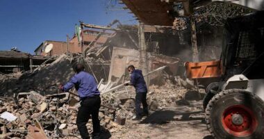
In 1952, before scientists had a strong understanding of plate tectonics, a 9.0-magnitude earthquake struck offshore of the Kamchatka peninsula in much the same region, sending a tsunami into the town of Severo-Kurilsk.
“People in Russia were not really prepared for it. It was very big earthquake, a big tsunami and they were caught off guard,” MacInnes said.
MacInnes said the tsunami produced was between 30 and 60 feet in height in southern parts of the peninsula.
“Thousands of people were killed and basically the town was destroyed,” said Joanne Bourgeois, an emeritus professor of sedimentology at the University of Washington, who has been studying the region’s earthquake history for about three decades.
How would the tsunami warning system perform if the earthquake struck closer to home?
The Kamchatka tsunami is a megathrust earthquake produced along large subduction zone fault, when one tectonic plate is forced beneath another. The U.S. west coast features a similar fault, called the Cascadia subduction zone, which runs offshore along the U.S. West Coast from Northern California to northern Vancouver Island.
“This is kind of a mirror image across the Pacific,” Tobin said. “An 8.8 at a relatively shallow depth in Cascadia is definitely in the realm of scenarios. We could have a similar event here.”
In fact, Cascadia has the potential to produce much larger quakes, Tobin said. Modeling suggests Cascadia could produce tsunami waves as tall as 100 feet.
Subduction zone earthquakes typically produce tsunamis that reach shore in about 30 minutes to an hour, Titov said, which would strain forecasters’ capabilities to predict tsunami effects precisely along the U.S. west coast before inundation happened.
Titov said more seafloor sensors, more computer processing and innovation with artificial intelligence algorithms are needed to speed forecasting.
Tobin said the successful tsunami warning on Tuesday should spur investment in seafloor sensors and seismic monitoring stations offshore along the subduction zone.
“This shows the value and importance of NOAA and the USGS [U.S. Geological Survey] in these times where some of these government agencies have come into question,” Tobin said. ”We wouldn’t have had a tsunami warning if it weren’t for NOAA and the next one could be a closer event. They showed their value.”