
Share this @internewscast.com
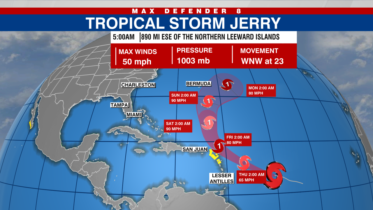
A Tropical Storm watch has been issued for areas of the northern Leeward Islands as Tropical Storm Jerry rapidly progresses west-northwestward, according to the National Hurricane Center (NHC).
Jerry is located about 890 miles east-southeast of the northern Leeward Islands and is moving toward the west-northwest at about 23 mph.
The NHC forecasts that Jerry will maintain this general path, although its forward speed is expected to slow over the next few days, with a projected turn toward the north-northwest on Friday.

The core of the system is expected to be near or to the north of the northern Leeward Islands late Thursday and Friday.
Maximum sustained winds are near 50 mph.
Strengthening is expected during the next few days, and Jerry is expected to become a hurricane on Thursday.
Southwestern Gulf
A large area of disorganized showers and thunderstorms over the Bay of Campeche is being caused by a trough of low pressure.
Slow development of this system is possible before it moves inland over southern Mexico later today and early Thursday, the NHC said.

Regardless of development, parts of southern Mexico could see heavy rain and gusty winds over the next day or so.
The chance of development in the next 48 hours is 10 percent.
The chance of development in the next seven days is 10 percent.
Watch Tracking the Tropics on Tuesdays at 12:30 p.m. ET/11:30 a.m. CT
Stay informed by listening on Spotify or Apple Podcasts. Equip yourself with the 2025 Hurricane Guide and stay updated on tropical systems by subscribing to the Tracking the Tropics newsletter.