
Share this @internewscast.com
ORLANDO, Fla. – Yesterday, we experienced showers and some pop-off thunderstorms forming early in the day before another round developed as our sea breezes started moving in from coast to coast.
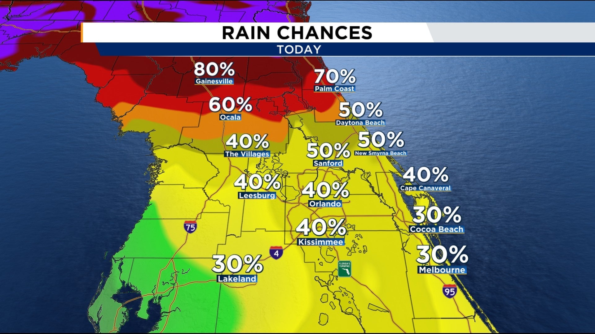
Sunday will likely be much of the same before your chance to see some additional rain goes up over the next couple days.
As our high pressure ridge moves from nearly directly over us into the western Atlantic, winds will begin to shift over the Florida peninsula.
This change could bring some early showers and an occasional thunderstorm or two toward the east coast before our east breeze kicks in during the warmest part of the afternoon. Then around 4-6 p.m., our greatest storm coverage will ignite.
Much like yesterday, it appears our west coast breeze will be more aggressive and push through much of the area before interacting with winds coming in from the east coast.
The bulk of our sea-breeze collision is expected to occur from Flagler County to Volusia and into parts of Seminole, eastern Orange, Osceola, and Brevard counties. This means you’re likely to see some significant thunderstorms and more heavy rain during the later part of your Sunday.
The heat will also persist. In fact, this morning we’ve seen little change in temperature since this time yesterday. Afternoon highs will reach the mid 90s across our area, with the heat index rising back into the triple digits.
Tomorrow and through to about Wednesday however, Central Florida receives a little nudge in the moisture department via the southerly flow provided by our Atlantic high pressure.
The clockwise spin is likely to draw some tropical moisture up from the Caribbean, further bringing up chances for rain as early as tomorrow.
We’re also watching newly designated Invest 95L right off the coast of North Carolina. Satellite this morning looks promising, as the feature further organizes.
Thankfully, rest assured this is staying far away from us in Florida.
Copyright 2025 by WKMG ClickOrlando – All rights reserved.