
Share this @internewscast.com
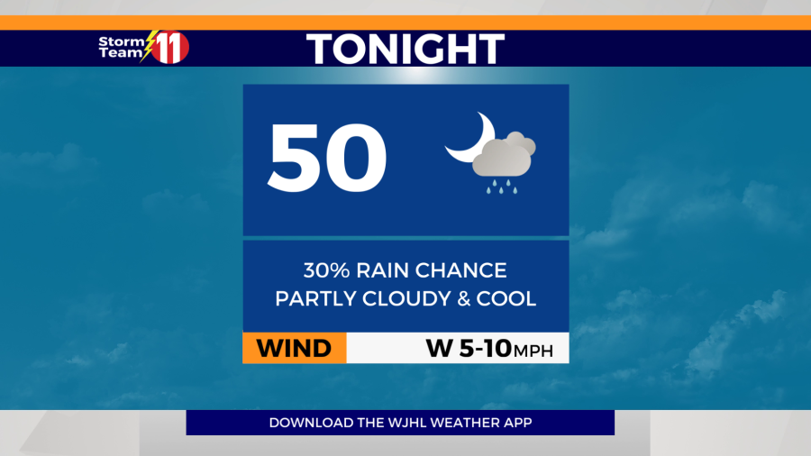
The Storm Team 11 forecast calls for partly cloudy skies with a 30% chance of scattered showers overnight with a low near 50 degrees.

On Sunday, expect a combination of sunshine and clouds with a 40% likelihood of scattered showers and thunderstorms around midday. Most of these rain chances will be concentrated in northeast Tennessee due to the presence of a front. There’s a potential for isolated strong to severe thunderstorms, primarily posing a risk of damaging winds. The temperature will reach a high of 75 degrees. By Sunday night, skies will clear up, and temperatures will drop to a low of 46 degrees.

On Monday, temperatures will rise toward typical seasonal highs with mostly sunny conditions. The high temperature is forecasted to be 80 degrees. Monday night will be clear with a low of 50 degrees.

The warming trend continues into Tuesday, accompanied by a few passing clouds. The temperature will peak near 83 degrees. Tuesday night, expect mostly clear skies, with a low of 58 degrees.
Wednesday will be mostly sunny, hot and humid. The high will be 85 degrees. Wednesday night will be mostly clear with a low of 61 degrees.

We stay hot and humid on Thursday with increasing clouds through the day. The high will be 85 degrees. Thursday night will be mostly cloudy and mild with a low of 64 degrees.

By Friday, the ridge of high pressure will start to break down with a 30% chance of scattered showers and thunderstorms. The high will be 82 degrees.
Showers and thunderstorms return to the forecast into next Saturday with a 60% rain chance. The high will be 81 degrees under mostly cloudy skies.