
Share this @internewscast.com
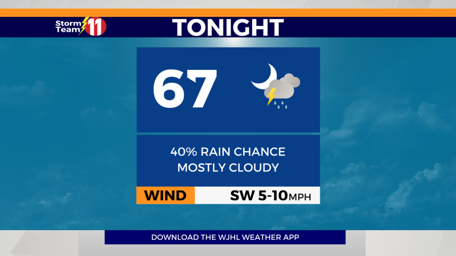
According to Storm Team 11’s forecast, expect scattered showers and a few thunderstorms to become more isolated overnight, with temperatures dropping to 67 degrees. There remains a risk of isolated flash flooding in low-lying regions due to ongoing heavy rainfall.


This rainy trend is set to continue into the start of next week, with an 80% chance of scattered showers and thunderstorms expected on Monday. The temperature will rise to a high of 84 degrees. Monday night will bring mostly cloudy skies and a slight chance of more showers and thunderstorms, with a low of 66 degrees.


Tuesday’s forecast includes mostly cloudy conditions with a 60% likelihood of scattered showers and thunderstorms. The high temperature will be around 86 degrees. As night falls, there’s still a potential for scattered showers and thunderstorms, with a low reaching 68 degrees.


Rain chances start to decrease by Wednesday 30% chance of isolated showers and thunderstorms. The high will be 87 degrees under mostly cloudy skies. A slight chance of a few showers and thunderstorms is possible Wednesday night with a low of 68 degrees.

Rain and thunderstorms become slightly more widespread by Thursday in advance of an approaching cold front under partly cloudy skies. The rain chance will be 70% with a high of 85 degrees. Thursday night will feature a slight chance of scattered showers and thunderstorms under mostly cloudy skies. The low will be 66 degrees.


Friday will be partly cloudy with a 20% chance of isolated showers and thunderstorms. The high will be 86 degrees. Friday night will clear out with a low of 61 degrees. Summer begins at 10:42 p.m.

Saturday will be mostly sunny with a 20% chance of isolated showers and thunderstorms. The high will be 88 degrees.
Next Sunday looks very hot and humid with a high near 90 degrees. A 30% chance of isolated showers and thunderstorms are possible across the higher terrain.
Have a great night.