
Share this @internewscast.com
SAVANNAH, Ga. () — Very slow changes are arriving to the weather pattern this week, but expect the comfortable air to continue Monday.
Sunday saw another pleasant day with the humidity dropping further due to consistent northeast winds. With high pressure to our north and an area of low pressure off the North Carolina coast, this pattern remains steady.
The low-pressure area will cause unsettled weather in parts of North Carolina, but a frontal boundary and several disturbances will stay well clear of our area.

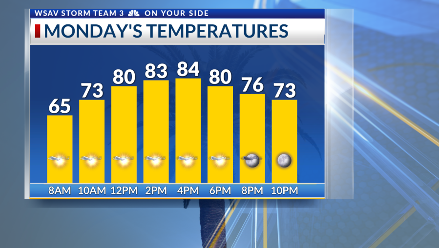
As high pressure begins to weaken early this week, expect humidity to increase along with gradual warming. Morning temperatures will moderate into the mid to upper 60s, and by the close of the workweek, afternoons will climb to the upper 80s.
Rain chances will be minimal from Monday through Wednesday. As more moisture enters the region, and an area of low pressure directs moisture into the Southeast, showers become possible towards the week’s end and into next weekend.


The tropics maintain a calm pattern close to home, with attention on a tropical wave southwest of the Cabo Verde Islands continuing.
This disturbance has a 70% probability of development over the next week. Early in the week, dry and stable air will hinder development or organization, but conditions are expected to become more favorable for a tropical cyclone by week’s end.
Steering patterns support any eventual development of this system moving west-northwestward, north of the Caribbean, and eventually turning north. This would keep it away from the US.
There continues to be no tropical threats to the Coastal Empire and Lowcountry at this time.