
Share this @internewscast.com
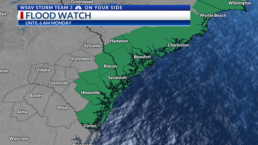
SAVANNAH, Ga. () — A Flood Watch remains in effect until 6 AM Monday for all of our coastal counties.
Tonight, any showers and storms that develop may lead to rainfall rates of 1-2 inches per hour, with some areas potentially experiencing local rainfall totals of 3-5 inches.
Rain early in the day Sunday led to more flood alerts for the coastal counties.
A lull settled in for the middle portion of Sunday before scattered showers and storms developed during the afternoon.
This activity mainly remained along and west of US-25, resulting in 1-3 inches of rain. Additional showers and storms are anticipated overnight, though most will form around daybreak.


Monday will bring a continuation of the unsettled, cooler pattern for one more day. A significant round of heavy rain and storms is expected in the early morning, so exercise caution during your commute.
A lull in activity is expected during the middle of the day. This will give way to more showers and storms during the afternoon.
The primary concern will be flooding rain, as rainfall rates exceeding 1-2 inches per hour on already saturated ground may cause issues in areas with poor drainage.


High pressure builds in across the Southeast US in the extended forecast. Hotter temperatures begin to return by Tuesday.
With abundant moisture and daytime heating, scattered thunderstorms are expected by the afternoon.
As upper-level ridging intensifies, sunshine and hotter conditions will dominate from mid to late week, with storm chances reducing to about 30% each day.
Remember to stay hydrated and cool as typical summer heat settles back in.
There are no significant changes in the tropics as of early Sunday evening. Invest 96-L has a 20% chance of developing, but this system will remain far east of the US.
Invest 97-L is looking healthier as thunderstorm activity is more persistent and the low-level spin is gradually organizing.
The National Hurricane Center is now giving the system a 50% chance of developing over the next 2 days, with 90% odds over the next 7 days.
Not much has changed regarding the forecast yet. Models continue to track the system westward, strengthen it into a hurricane over time, and the long-range details are still not locked in yet.
By next weekend, most guidance has a system either near or north of the Caribbean. It is simply too early to know how the system will be steered. Continue to keep an eye on the forecast as it evolves.
There are currently no imminent tropical threats for the Coastal Empire & Lowcountry.