
Share this @internewscast.com
Some Storms Tonight
This evening, isolated storms are expected to persist but should dissipate as daytime heating decreases. However, there is still a possibility of isolated showers and storms occurring between midnight and 5 AM as a diminishing storm complex passes through the area.
Hot Temperatures & Breezy
On Sunday, the day will begin warm and humid, with temperatures around the mid-70s. Look for winds to strengthen from the southwest as we anticipate showers and storms. Outside of storms, it’s important to stay aware of the heat as temperatures will climb into the 90s, feeling as hot as 100°-105° in the sun.
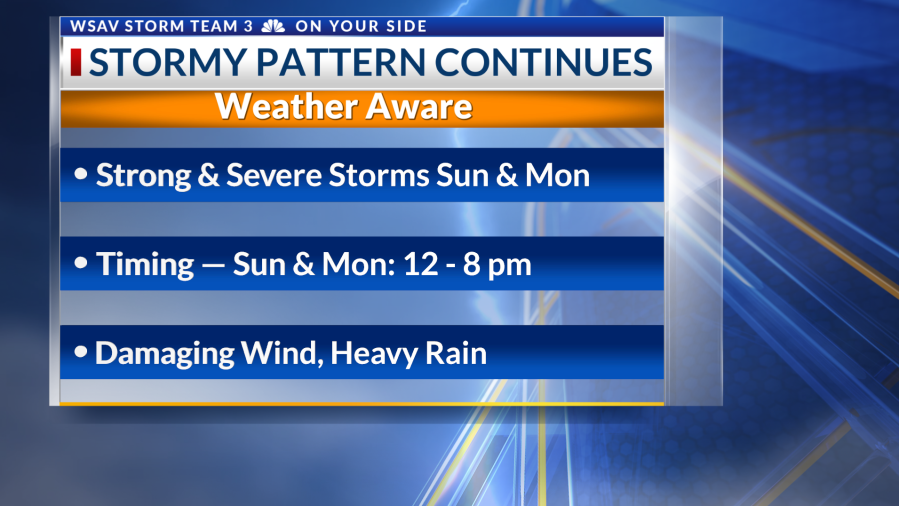
Weather Aware Days
Sunday and Monday have been designated as Weather Aware Days due to the risk of scattered severe storms. These thunderstorms might produce damaging straight-line wind gusts, frequent lightning, and localized flooding in areas with poor drainage.
Storms Sunday will begin to make their way into the Coastal Empire & Lowcountry by midday. Between 12 PM and 8 PM, expect scattered storms with some activity turning strong and severe. Damaging winds are the main threat with the initial storms. A flooding threat will come to fruition if additional rounds of storms fire up behind the main line.

A similar setup is expected Monday as waves of mid-level energy transport thunderstorm clusters eastward. In addition to that, typical daily seabreeze storms will fire up. Expect this pattern to stick around for the new week.