
Share this @internewscast.com
SAVANNAH, Ga. () — The unsettled conditions continued Saturday with periods of rain and storms throughout the day.
Abundant rainfall on already saturated ground caused trouble spots in Beaufort County, the Richmond Hill area, the Chatham County Islands, and other parts of the Coastal Empire and Lowcountry.
Passing showers and occasional thunder are expected to persist into this evening. Rain chances will decrease by late Saturday night into early Sunday as a low-pressure system shifts away from the region.
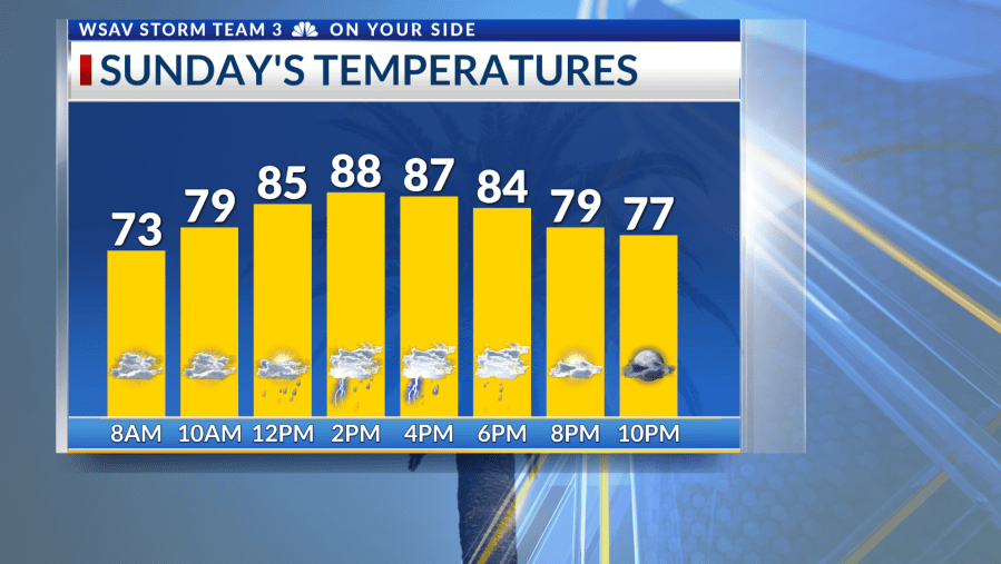
On Sunday, scattered storms are possible if ample sunshine breaks through. Although the flood risk isn’t particularly high, heavy rain could cause localized flooding that day.


As the new week begins, there will be a refreshing break from frequent rain, with Monday presenting only a slight chance of isolated storms. A cold front is anticipated to move through the area Monday into Tuesday, resulting in cooler temperatures.
From Tuesday through at least next weekend, rain chances will remain low at 20% each day. Mornings will be comfortable, with most areas starting in the 60s, and afternoon temperatures expected to be about 5° below average.
In the tropics, Tropical Storm Fernand has formed in the Central Atlantic. This system is forecast to move northward and pose no threat to land.
Invest 99-L is traveling westward towards the Caribbean. Although there’s only a 20% chance of development before conditions become unfavorable, it deserves monitoring as it continues through the Caribbean Sea.
There are no tropical threats to the Coastal Empire and Lowcountry at this time.