
Share this @internewscast.com
SAVANNAH, Ga. () — Mild weather continues through the rest of the weekend as a cool pattern remains locked in place.
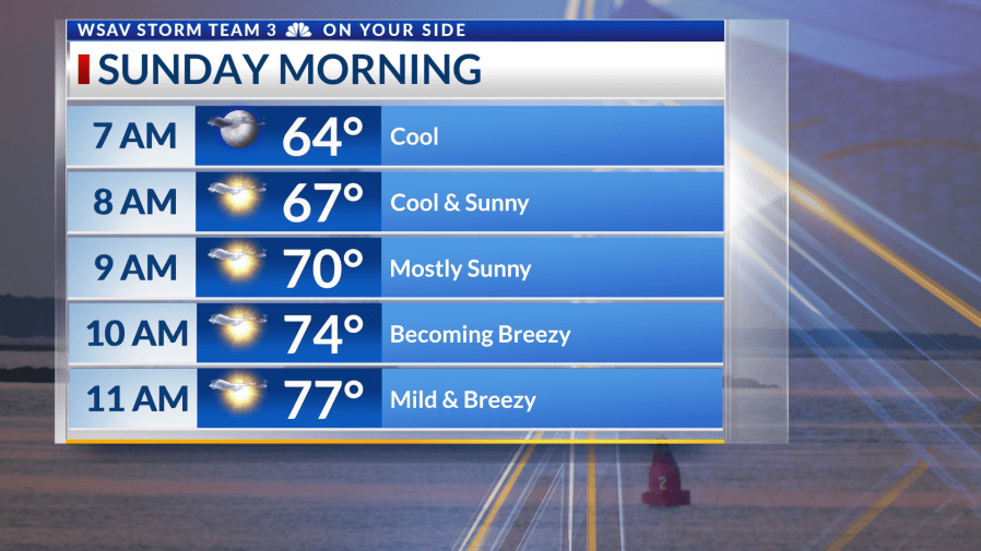
Sunday morning is expected to be pleasant once more, with temperatures in the 60s and mainly sunny skies. Winds from the northeast will occasionally be breezy throughout the day.


The forecast remains largely unchanged due to high pressure persisting to our north. This, along with an area of low pressure forming off the Southeast Coast, ensures that winds continue from the northeast, keeping the air mild.
Humidity will increase by midweek and rain chances come into play for the end of the week. Until then, enjoy the fall-like weather pattern.


The tropics are staying calm in the Gulf, Caribbean, and Southwest Atlantic. High wind shear persists, which does not support the development of any homegrown tropical systems.
A tropical wave moving away from the African coast is experiencing intermittent thunderstorm activity but remains disorganized. The National Hurricane Center has given it a 50% chance of evolving into a tropical depression or named storm.
Gradual organization is possible during the mid to latter parts of next week, provided it can overcome the dry air and shear affecting the tropical Atlantic.
There continues to be no tropical threats for the Coastal Empire and Lowcountry.