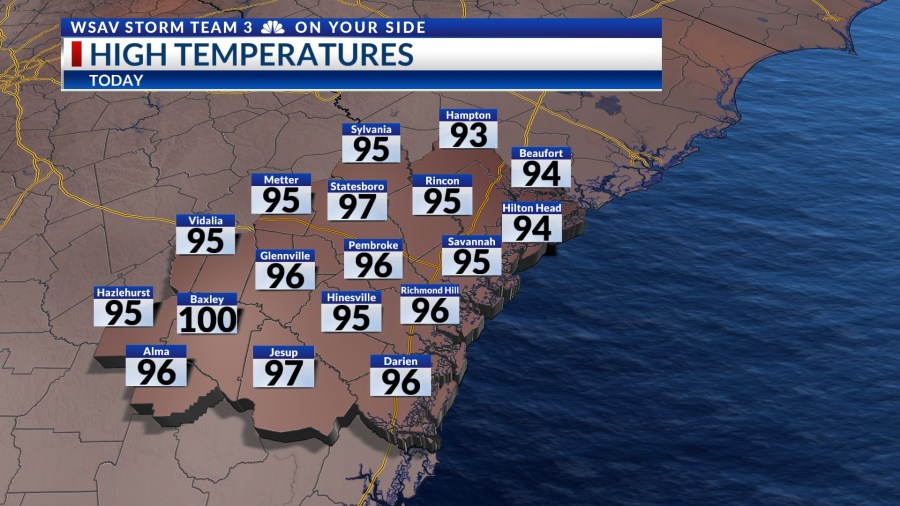

SAVANNAH, Ga. () — Wednesday afternoon and evening experienced high temperatures and humidity with a few isolated showers and storms. Many areas saw highs reaching into the upper 90s to 100°F.
Heat index values were 105°-110°F. Locations that received some rain in the late afternoon and evening were able to cool off significantly.

A LOOK AHEAD
Additional summer heat is anticipated locally on Thursday and Friday. Afternoon highs are expected to peak in the mid and upper 90s, with heat index values exceeding 105°F on both afternoons.
A heat advisory has been issued for most of the Coastal Empire and Lowcountry Thursday afternoon and into the evening.


A cold front tracked by Storm Team 3 is currently advancing through the central part of the country. It is projected to gradually move into the southeast by the weekend, which will contribute to a cooling trend for several days.
Afternoon highs over the weekend and into next week will be trending below normal in the mid and upper 80s to about 90°F.


However, this approaching font will help to direct deeper Gulf and tropical moisture into the region, leading to higher rain and storm chances.
Heavy rain is expected on Saturday and Sunday with totals between 2-3″.
Localized higher rainfall amounts are possible, with a risk of flooding in poorly drained areas. Scattered showers and storms are also anticipated to persist into the following week.


TRACKING THE TROPICS
The basin remains calm for the moment with a few weak tropical waves present in the open Atlantic, warranting long-term observation. However, no development is projected for the next five to seven days.
The tropical waves will be moving into the main regions we look for tropical development during August.
As the season progresses, development typically shifts eastward, with water temperatures beginning to rise. Currently, water temperatures are trending near normal across the equatorial Atlantic.