
Share this @internewscast.com
SAVANNAH, Ga. () — Tuesday was a pretty nice and comfortable day with low humidity and mild temperatures.
Afternoon temperatures mainly peaked in the lower 80s for the majority of areas. However, some locations in the southwestern region experienced highs in the mid to upper 80s.
Warmer afternoon highs are in the forecast for the rest of the week, but low humidity will continue to lead to comfortable conditions.
A cold front that passed through over the weekend is now stationed just off the coast by Tuesday evening. This is causing a northerly breeze to persist, bringing in drier air.

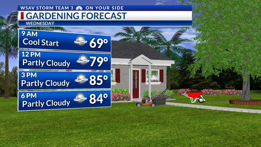
Wednesday afternoon will become a little warmer with a mix of clouds and sunshine.
Temperatures are expected to reach the mid to upper 80s. Similar weather is anticipated for Thursday. By Friday and into the weekend, a warmer and more humid air mass is expected to move in.
Highs will be in the upper 80s. Higher humidity will make conditions feel a bit hotter for Saturday and Sunday.
No significant rain chances are in the local seven-day forecast until the later part of next week.

TRACKING THE TROPICS
Even through the peak of the Atlantic hurricane season is Wednesday, no development is expected over the next five to seven days.
Any approaching tropical waves over the next week or so will face challenges from strong wind shear and dry air, creating a very inhospitable environment for any tropical system to develop.