
Share this @internewscast.com
SAVANNAH, Ga. () — Tuesday afternoon was mainly sunny and warm. Low humidity led to comfortable conditions.
With high pressure staying in place over the southeast, more sunny and warm afternoons are expected through the week.
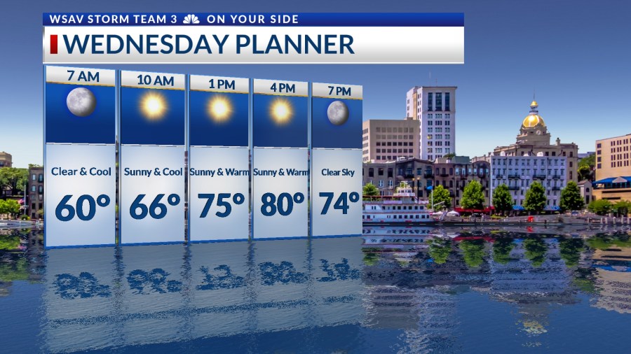
On Wednesday, the day will begin with morning temperatures dipping into the mid and upper 50s. A predominantly sunny sky will facilitate a rapid warm-up into the 70s by late morning.

Afternoon temperatures will peak in the upper 70s near the coast, reaching lower 80s inland. Breezy conditions are expected throughout the day, with a northerly breeze ranging between 10 and 15 mph.
Overall, the weather pattern will remain unchanged through the rest of the work week and into the weekend with the exception of cooler mornings.
For Friday and Saturday morning, predicted low temperatures in Savannah are anticipated to fall into the low to mid 50s. Many inland areas might experience temperatures dropping into the upper 40s.

The weekend kicks off with mostly sunny and warm conditions on Saturday, with highs again reaching the upper 70s to lower 80s. Cloud cover will begin to increase on Sunday as a new weather system approaches.
A cold front moving through the southeast will bring a few showers late on Sunday and possibly into early Monday morning.

TRACKING THE TROPICS
The National Hurricane Center (NHC) is continuing to issue advisories for Tropical Storm Lorenzo, which is located in the central Atlantic Ocean. As of Tuesday evening, Lorenzo is showing signs of weakening, appearing less organized on infrared satellite imagery.

As of 5 p.m. EDT, Lorenzo has sustained winds of 40 mph with gusts reaching up to 50 mph. The storm is moving northward out of the tropics, and as it moves further north, the environment will become more inhospitable for tropical systems.
Tropical Storm Lorenzo is forecast to weaken into a tropical depression by late Wednesday or early Thursday.
There is no threat to the U.S. or any land from Lorenzo.


The NHC is not currently monitoring any other areas for potential tropical development across the Atlantic basin at this time. Some long-range guidance indicates that the Caribbean may be an area to watch later in the month for potential development.