
Share this @internewscast.com
SAVANNAH, Ga. — Thursday dawned with some of the season’s coolest temperatures across the Coastal Empire and Lowcountry.
Temperatures in several inland areas dipped into the 30s. However, as the day progressed, it warmed considerably, with highs reaching between the upper 70s and lower 80s.


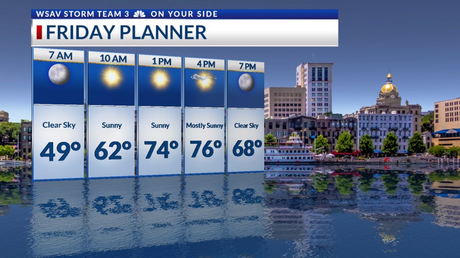
Looking ahead to Friday and the weekend, expect predominantly sunny skies and very warm afternoons. Mornings will start off on the colder side, with temperatures dropping to the 40s or low 50s.
Throughout the days, ample sunshine is set to boost temperatures quickly to the mid to upper 70s.
As a storm system begins to make its way toward the area on Sunday, there is a chance of a few isolated showers late in the day, which might extend overnight into Monday.

Monday’s forecast includes a cold front moving through, bringing with it the potential for scattered showers. There is also a possibility of encountering some heavy rain in certain areas.
Afternoon high temperatures will reach the upper 60s to lower 70s.
Tuesday and Wednesday will be partly cloudy with a few passing showers. Afternoon high temperatures will remain below normal in the upper 60s to lower 70s.
Another cold front is forecast to move through the southeast on Thursday. A few scattered showers are possible throughout the day.
Highs will be in the upper 60s and lower 70s again.

A strong breeze will make conditions feel a little cooler at times.
Halloween and into next weekend look to be mainly sunny and cooler behind Thursday’s cold front as high pressure builds into the region.
TRACKING THR TROPICS
Tropical Storm Melissa is still located in the central Caribbean Sea.
It is a ragged looking system on satellite imagery as of Thursday evening due to it encountering some windshear. However, there are some bursts of convective thunderstorms that have been developing near the center of circulation.
Melissa has sustained wind of 45 mph as of 8 p.m. EDT with higher wind gusts. It is nearly stationary as it drifts northward at just 2 mph.
This system is forecast to become better organized and intensify as it moves toward Jamacia over the weekend and into next week.
Melissa is currently forecast to brus along the southern coast of Jamacia as a category 4 hurricane on Monday and Tuesday.
Long-range guidance indicates that Melissa will begin to turn to the north toward Cuba by the middle of next week. Eventually Melissa should cross over into the western Atlantic over the Bahamas and Turks and Caicos later in the week.
It will likely stay well away from the southeastern U.S. coast as a couple of cold fronts are forecast to move off of the coast. Added wind shear and cooler water temperatures will help to weaken Melissa.
Tropical Storm Melissa poses no threat to the U.S. at this time.